
Native name 鈴鹿川 Basin size 323 km (125 sq mi) Discharge 7.21 m³/s | River mouth Ise Bay Length 40 km Basin area 323 km² | |
 | ||
Main source Mount Nasugahara800 m (2,600 ft) | ||
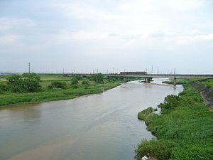
The Suzuka River (鈴鹿川, Suzuka-gawa) is a major river that flows through northern Mie Prefecture on the island of Honshū, Japan. It is officially classified as a Class 1 river by the Japanese government, one of four Class 1 rivers that flow solely through Mie.
Contents
Map of Suzuka River, Shiohamacho, Yokkaichi, Mie Prefecture, Japan
The river's source is on Mount Nasugahara, which stands on the border of Mie and Shiga Prefectures. From the mountain, it then flows eastwards, eventually flowing into Ise Bay.
A section of the Tōkaidō, a major travel route in the Edo era, ran along the north side of the river for most of its course. The modern versions of this portion of the old Tokaido, the Kansai Main Line and Route 1, likewise run parallel with the river.
References
Suzuka River Wikipedia(Text) CC BY-SA