
Country Thailand Time zone THA (UTC+7) Area 646.1 km² Geocode 3905 | Seat Suwannakhuha Postal code 39270 Province Nong Bua Lamphu Province | |
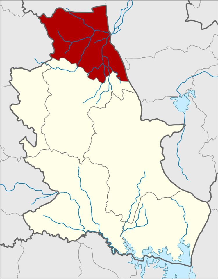 | ||
Suwannakhuha (Thai: สุวรรณคูหา; [sù.wān.nā.kʰūː.hǎː]) is the northernmost district (Amphoe) of Nongbua Lamphu Province, northeastern Thailand.
Contents
- Map of Suwannakhuha District Nong Bua Lam Phu 39270 Thailand
- History
- Geography
- Administration
- References
Map of Suwannakhuha District, Nong Bua Lam Phu 39270, Thailand
History
The minor district (King Amphoe) was created on July 17, 1973, when the three tambon Na Si, Ban Khok and Na Di were split off from Na Klang district. It was upgraded to a full district on March 25, 1979. In 1993 it was one of five districts of Udon Thani province which formed the new province Nong Bua Lam Phu.
Geography
Neighboring districts are (from the south clockwise) Na Klang of Nongbua Lamphu Province, Na Duang of Loei Province, Nam Som, Ban Phue, Kut Chap of Udon Thani Province.
Administration
The district is subdivided into eight subdistricts (tambon), which are further subdivided into 92 villages (muban). There are two townships (thesaban tambon) - Suwannakhuha covers parts of the tambon Suwannakhuha, Na Si, and Kut Phueng; and Ban Khok covers parts of tambon Ban Khok. There are further seven "tambon administrative organizations" (TAO).