
Population 232 (in 2011) Civil parish Sutton Mandeville Region South West Dialling code 01722 Post town Salisbury | OS grid reference ST987289 Unitary authority Country England Ceremonial county Wiltshire UK parliament constituency South West Wiltshire | |
 | ||
Sutton Mandeville is a village and civil parish in Wiltshire, England. The village lies off the A30 road in the Nadder valley between the city of Salisbury in Wiltshire and the town of Shaftesbury in neighbouring Dorset. The parish includes the hamlets of Lower Chicksgrove and Sutton Row.
Contents
Map of Sutton Mandeville, Salisbury, UK
Governance
The parish has a locally-elected parish council, which was created in 1974 to replace the earlier parish meeting. This is consulted on all parish matters, while most significant local government functions are carried out by the Wiltshire Council unitary authority.
Until 1986 Sutton Mandeville was part of Tisbury parish.
Amenities
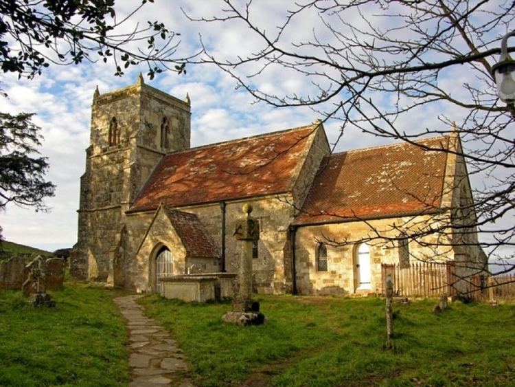
The Anglican Church of All Saints dates from the 13th century and has a 15th-century tower. It was restored in 1862 by T.H. Wyatt and is Grade II* listed.
There is a pub called The Compasses Inn at Lower Chicksgrove.