
Time zone CET (UTC+1) Area 17.78 km² Population 509 (1999) | Canton Léré INSEE/Postal code 18257 /18240 Local time Saturday 2:42 PM | |
 | ||
Weather 17°C, Wind SW at 11 km/h, 56% Humidity | ||
Sury-près-Léré is a commune in the Cher department in the Centre region of France.
Contents
Map of 18240 Sury-pr%C3%A8s-L%C3%A9r%C3%A9, France
Geography
A farming area comprising the village and several hamlets situated by the banks of the Loire lateral canal about 36 miles (58 km) northeast of Bourges at the junction of the D152 and the D751 roads. The Loire River forms the eastern boundary of the commune.
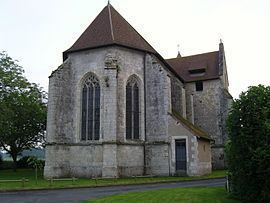
Sights
References
Sury-près-Léré Wikipedia(Text) CC BY-SA