
Legislature House of Commons First contested 1988 District webpage profile, map Province British Columbia Elector 68,137 | District created 1986 Last contested 2011 Population (2011) 125,963 District abolished 2013 | |
 | ||
Census divisions Metro Vancouver Regional District, Surrey | ||
Bantam highlights surrey north vs valley thunder sept 16th 2016
Surrey North was a federal electoral district in British Columbia, Canada, that has been represented in the House of Commons of Canada since 1988. It covers the northern part of Surrey.
Contents
- Bantam highlights surrey north vs valley thunder sept 16th 2016
- Geography
- History
- Election results
- References
It was home to 106,904 residents in 2001, more than 46 percent of whom are immigrants—21 percent of residents are East Indian, the second-highest concentration in Canada.[1] Most residents are employed in the manufacturing and service sectors, with an average family income of $50,445 and an unemployment rate of nine percent.[2]
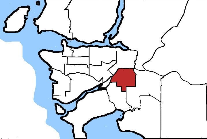
Geography
Bounded by the Fraser River at the north and west, the riding stretched south to 88th Avenue, King George Highway, 120th Street, and 96th Avenue, and east to Fraser Highway and 152nd Street.
History
The riding was formed in 1986 from portions of Surrey—White Rock—North Delta, Surrey Central, and Fraser Valley West ridings. The riding was revised in 1996 and 2003.
Election results
* Note: Chuck Cadman's share of the popular vote as an independent candidate declined by -12.31 from his share as the Canadian Alliance candidate in the 2000 election.
Note: Conservative Party vote is compared to the total of the Canadian Alliance and Progressive Conservative vote in the 2000 election.
Note: Canadian Alliance vote is compared to the Reform Party vote in the 1997 election.