
Country Thailand Time zone ICT (UTC+7) Province Surat Thani Province | Elevation 30 ft (10 m) Local time Saturday 1:28 PM | |
 | ||
District Amphoe Mueang Surat Thani Weather 32°C, Wind NE at 13 km/h, 61% Humidity Points of interest Thale Nai, Ko Lamphu, Khao Tha Phet, Ko Lamphu Public Park, Wat Bang Bai Mai | ||
Surat thani pools cafe s and good time in thailand
Surat Thani (Thai: สุราษฎร์ธานี, [surâːt tʰaːniː], Pronunciation) is a city in Amphoe Mueang Surat Thani, Surat Thani Province, southern Thailand. It lies 651 km south of Bangkok. It is the capital of the province Surat Thani. The city has a population of 128,179 (2009), and an area of 68.97 square kilometers. The city's population density is 1,858.47 inhabitants per km².
Contents
- Surat thani pools cafe s and good time in thailand
- Map of Surat Thani Mueang Surat Thani District Surat Thani Thailand
- History
- Climate
- Rail
- Road
- Air
- Water
- Administration
- References
Map of Surat Thani, Mueang Surat Thani District, Surat Thani, Thailand
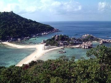
Surat Thani is near the mouth of the river Tapi on the Gulf of Thailand. The city offers no major tourist attractions in itself, and is thus mainly known to tourists as a transfer to the nearby popular Ko Samui and Ko Pha Ngan islands. It forms the regional commercial center, with a seaport dealing in the main products of the province, rubber and coconuts.
History
The city received its name, which means "city of good people", by King Vajiravudh (Rama VI) in 1915. The name was given to the city due to the intense devotion of the locals to Buddhism. Previously the city was known as Bandon, meaning "village on higher ground". The name of the city is taken from the Indian city Surat in Gujarat on the Indian river Tapi. King Vajiravudh (Rama VI) gave this name to his city as he was impressed with the Indian city.
On December 21, 1930 Surat Thani became a sanitary district (sukhaphiban), which was upgraded to a town (thesaban mueang) on December 7, 1935, with a municipal area of 2.67 km². The area of the municipality was enlarged to 6.95 km² on October 14, 1958, and on December 22, 1994 it was further enlarged to 68.97 km². On May 4, 2007, the town was upgraded to city status (thesaban nakhon).
Since 1969 Surat Thani is the seat of the Roman Catholic Diocese of Surat Thani, responsible for about 6000 Catholic Christians in southern Thailand.
Climate
Surat Thani has a tropical savanna climate (Köppen climate classification Aw). Temperatures are fairly stable until throughout the year, although the pre-monsoon months (March–May) are somewhat hotter. There is a short dry season from January to April, followed by the wet season that lasts from May to December. The heaviest rains occur in October and November.
Rail
Surat Thani is connected with Bangkok by the Southern Line of the State Railway of Thailand. Surat Thani Railway Station is the main station of the province. It is in Phunphin, about 15 kilometres (9.3 mi) from the Surat Thani.
Road
Surat Thani is connected to Nakhon Si Thammarat by Route 401. Asian highway AH2 also passes the city at Phunphin.
Air
Surat Thani International Airport is about 30 kilometres (19 mi) from the city by road.
Water
Some ferries to Ko Samui depart from the downtown port. The main ferry pier is at Don Sak, 40 kilometres (25 mi) east (about 60 kilometres (37 mi) by road) on the coast of gulf.
Administration
Surat Thani covers the tambon Talad and Bang Kung, and parts of the tambon Khlong Chanak, Bang Chana, Bang Baimai and Makham Tia, all part of the Mueang Surat Thani district. The city is subdivided into 45 communities (chumchon).