
Country India State | Languages spoken District Supaul | |
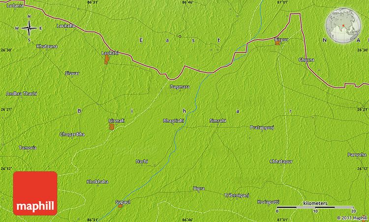 | ||
Map of Supaul
Supaul is a town and a municipality that is headquarters of Supaul district in the Indian state of Bihar. The Supaul town is the administrative headquarters of this district.
Contents
- Map of Supaul
- Flood in biharsupaul araria 5
- Flood in biharsupaul araria 4
- Geography
- Demographics
- Evacuations in progress in bihar but food and tents limited
- References
Flood in bihar(supaul & araria) 5
Flood in bihar(supaul & araria) 4
Geography

Supaul is located at 25.93°N 86.25°E / 25.93; 86.25. It has an average elevation of 34 metres (111 feet).
Demographics
As of 2011 India census, Supaul had population of 2,228,397 of which male and female were 1,157,815 and 1,070,582 respectively. The initial provisional data suggest a density of 919 in 2011 compared to 714 of 2001.
Evacuations in progress in bihar but food and tents limited
References
Supaul Wikipedia(Text) CC BY-SA