
Country Tibet, Nepal Source Tibet | River system Koshi River Mouth Arun River, China-Nepal | |
 | ||
Main source Tibet
8,012 m (26,286 ft) River mouth Confluence with Arun and Tamur to form Saptkoshi at Trivenighat, Nepal
640 m (2,100 ft) Tributaries Left:
Tamba Koshi, Likhu Khola, Dudh Koshi
Right:
Indravati River Bridges Sino-Nepal Friendship Bridge | ||
Sun kosi river in nepal trip 2013
The Sun Kosi, also called Sun Koshi, is a trans-boundary river that originates in the Tibet and it is part of the Koshi or Saptkoshi River system in Nepal.
Contents
- Sun kosi river in nepal trip 2013
- Sun kosi whitewater rafting nepal
- River course
- Names and etymology
- Koshi River system
- Sun KosiKamala multipurpose project
- Hazards
- Water sports
- References
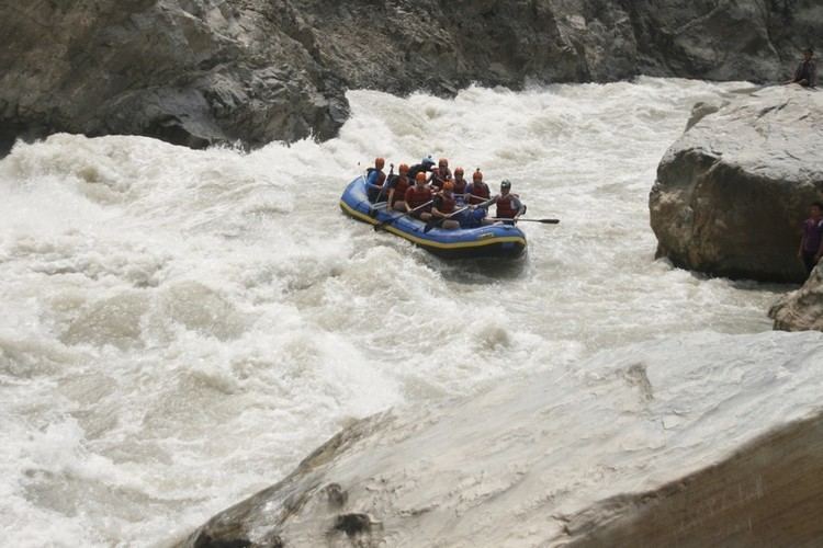
Sun kosi whitewater rafting nepal
River course
The Sun Kosi's headwaters are located in the Zhangzangbo Glacier in Tibet. Its upper course, the Bhote Koshi, is known as Poiqu in Tibet. Both river courses together form one basin that covers an area of about 3,394 km2 (1,310 sq mi).
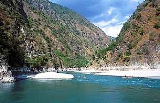
The Indravati meets the Sun Kosi at Dolaghat, up to where it is followed by the Arniko Rajmarg. From there, the Sun Kosi flows eastwards through the valley formed between the Mahabharat Range and the Himalayas. Tamakosi, Likhu, Dudhkosi, Arun and Tamor are its left tributaries and Indravati is the right tributary.
The average annual flow is 22 x 109 m3. The average sediment load is 54 x 106 m3.
The Tamur and the Arun rivers join the Sun Kosi at Tribenighat to form the Saptkoshi, which flows through the Chatra Gorge across the Mahabharat Range on to the Gangetic plain.
There are few more smaller tributaries of the Sun Kosi such as Rosi Khola, Junga Khola,and Sapsu Khola.
Names and etymology
Nepali: सुनकोशी
In Nepali language, the word "sun" means gold and golden; and the word "kosi" means river.
Koshi River system
The Koshi River drains eastern Nepal. It is also known as Saptkoshi River because of the seven rivers joining in east-central Nepal to form this river. The main rivers forming the Koshi River system are Sun Koshi, Indravati, Tamba Koshi, Bhote Koshi, Dudh Kosi, Arun and Tamur Rivers. The Saptkoshi River flows through the Chatra Gorge in a southerly direction into northern Bihar and joins the Ganges.
The Sun Koshi contributes about 44% of the total water of the Saptakoshi, the Arun 37% and the Tamur 19%.
Sun Kosi–Kamala multipurpose project
The Sun Kosi has a 90% reliable flow of 126 cubic metres per second (4,400 cu ft/s). It has been proposed that water be diverted from a small weir across the river near Kurule through a 16.6 kilometres (10.3 mi) tunnel and a 61.4 MW associated power house to the Kamala River, flowing through central Nepal. Some 72 cubic metres per second (2,500 cu ft/s) of water would be transferred to the Kamala River for the purposes of irrigation and further generation of power.
Hazards
In July 1981, a sudden ice avalanche caused a Glacial Lake Outburst Flood in the moraine-dammed Zhangzangbu-Cho Lake in the headwaters of the Poiqu in Tibet. The ensuing debris flow destroyed bridges, and sections of both the Arniko and the Nepal–China highways.
On 2 August 2014, a landslide blocked the river downstream from Barabise and created a large lake that submerged a hydropower station. The collapsed river bed buried several houses, more than 30 people died. The area has been declared a flood crisis zone, and local communities are evacuated. Power supply is interrupted, and the Arniko Highway blocked. See also 2014 Sunkoshi blockage
Water sports
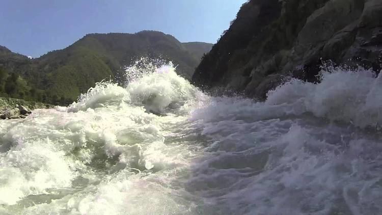
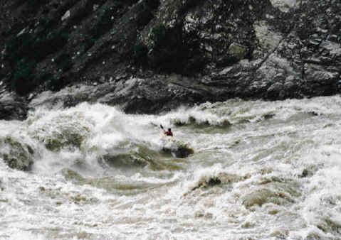
The Sun Kosi is used for both rafting and intermediate kayaking. It has grade III-IV rapids. The most common put in point of a Sun Kosi river trip is Dolalghat, at a height of 620 m (2,030 ft) and it ends at the Chatra Gorge at 115 m (377 ft), a distance of around 272 km (169 mi).