
Time zone EET (UTC+2) Elevation 130 m | City Istanbul Area code(s) 0-216 | |
 | ||
Website www.sultanbeyli.bel.tr www.sultanbeyli.gov.tr | ||
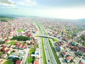
Sultanbeyli ([sulˈtanbejli]) is a working class suburb of Istanbul, Turkey on the Asian side, inland from Kartal and Pendik. It has a population of 298,143 as of 2011, more than triple the 1990 figure of 82,298. The mayor is Hüseyin Keskin of the AKP. Its neighbours are Sancaktepe from west, Pendik from east and Kartal from northwest.
Contents
Map of Sultanbeyli%2F%C4%B0stanbul, Turkey
History
Until recently Sultanbeyli was farmland. During the 1940s and 1950s large land holdings of the Ottoman period were parcelized for the settlement Turkishs migrants from Bulgaria. A village was built in the 1950s on one of the main highways connecting Istanbul to hinterland. It was part of Kartal district till 1992.
References
Sultanbeyli Wikipedia(Text) CC BY-SA