
Country United States Time zone Central (CST) (UTC-6) Zip code 63080 Local time Thursday 8:28 PM | Elevation 981 ft (299 m) Area code(s) 573 Population 7,075 (2013) | |
 | ||
Weather 10°C, Wind SW at 14 km/h, 78% Humidity University Andrews Academy of Cosmetology | ||
Sullivan missouri
Sullivan is a city that straddles the border of Franklin County and Crawford County in the U.S. state of Missouri. The population was 7,081 at the 2010 census.
Contents
- Sullivan missouri
- Map of Sullivan MO 63080 USA
- History
- Geography
- Government
- 2010 census
- 2000 census
- Education
- Notable people
- Historic places
- Local Manufacturing
- References
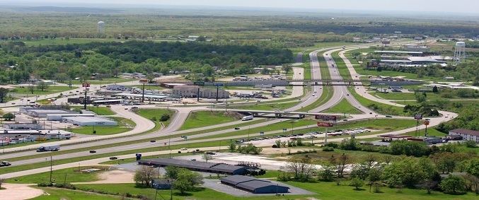
Map of Sullivan, MO 63080, USA
History
On January 28, 1839, 120 acres were conveyed by the U.S. Government to Garretson (also spelled Garrison) P. Hardy. Purchased according to provisions of the Act of Congress for the sale of public lands (dated April 1820). Then in June 1848, Garretson sold the acreage to William & Mary Smith for $150. In June 1856, Stephen & Dorcas Sullivan purchased the acreage, plus an additional 49 acres from Smith for the sum of $400. This was future site of the original town. On July 25, 1856, when a post office was established in present-day Sullivan, the local postmaster named the place "Mount Helicon". This short-lived name was after an actual mountain in Greece that was the mythical sanctuary of the Muses. In 1859, Stephen Sullivan donated ground for railroad right-of-way and built the depot himself. The railroad named the station “Sullivan” prompting the post office to change to Sullivan.
Between 1920 and 1960 the city grew from 900 to more than 4,000 residents, making Sullivan the second fastest-growing city in the state during that time.
The Maj. Gen. William S. Harney Summer Home was listed on the National Register of Historic Places in 1984.
Geography
Sullivan is located at 38°12′34″N 91°9′53″W (38.209562, -91.164656).
According to the United States Census Bureau, the city has a total area of 7.90 square miles (20.46 km2), all of it land.
Government
Governed by a Mayor and six members of the Board of Aldermen and assisted by a City Administrator, the City oversees a budget of $25 million. The City of Sullivan provides services in the areas of electric distribution, water, sewer, streets, aviation, parks and recreation, engineering, economic development, solid waste collection and law enforcement with a total of 60 full-time employees. The City operates on a very solid financial basis as demonstrated in its reserves. The local tax levy of 43.39 cents and utility rates are among the lowest in the area. A two cent sales tax for general revenue, capital improvements, and transportation provides the largest revenue source.
The Board of Aldermen meets at 7:00 p.m. on the first and third Tuesday of each month. The Board relies on the aid and counsel of numerous boards and commissions, including the Planning & Zoning, Airport Board, Industrial Development Authority and Board of Adjustment that meet as needed. The Planning and Zoning Commission meets on the second Tuesday of each month at 7:00 p.m.[1]
2010 census
As of the census of 2010, there were 7,081 people, 2,829 households, and 1,793 families residing in the city. The population density was 896.3 inhabitants per square mile (346.1/km2). There were 3,136 housing units at an average density of 397.0 per square mile (153.3/km2). The racial makeup of the city was 97.4% White, 0.2% African American, 0.4% Native American, 0.4% Asian, 0.6% from other races, and 1.0% from two or more races. Hispanic or Latino of any race were 2.2% of the population.
There were 2,829 households of which 34.3% had children under the age of 18 living with them, 41.9% were married couples living together, 15.7% had a female householder with no husband present, 5.8% had a male householder with no wife present, and 36.6% were non-families. 31.0% of all households were made up of individuals and 14.4% had someone living alone who was 65 years of age or older. The average household size was 2.44 and the average family size was 3.03.
The median age in the city was 35.6 years. 26.5% of residents were under the age of 18; 9.4% were between the ages of 18 and 24; 25.7% were from 25 to 44; 21.7% were from 45 to 64; and 16.6% were 65 years of age or older. The gender makeup of the city was 47.4% male and 52.6% female.
2000 census
As of the census of 2000, there were 6,351 people, 2,585 households, and 1,682 families residing in the city. The population density was 828.4 people per square mile (319.7/km²). There were 2,775 housing units at an average density of 362.0 per square mile (139.7/km²). The racial makeup of the city was 98.38% White, 0.20% African American, 0.20% Native American, 0.55% Asian, 0.05% Pacific Islander, 0.20% from other races, and 0.41% from two or more races. Hispanic or Latino of any race were 1.20% of the population.
There were 2,585 households out of which 31.6% had children under the age of 18 living with them, 48.3% were married couples living together, 12.8% had a female householder with no husband present, and 34.9% were non-families. 29.9% of all households were made up of individuals and 15.4% had someone living alone who was 65 years of age or older. The average household size was 2.40 and the average family size was 2.97.
In the city, the population was spread out with 25.9% under the age of 18, 9.3% from 18 to 24, 27.5% from 25 to 44, 19.5% from 45 to 64, and 17.9% who were 65 years of age or older. The median age was 36 years. For every 100 females there were 89.7 males. For every 100 females age 18 and over, there were 82.3 males.
The median income for a household in the city was $30,046, and the median income for a family was $36,260. Males had a median income of $29,817 versus $20,385 for females. The per capita income for the city was $17,518. About 6.9% of families and 11.0% of the population were below the poverty line, including 13.7% of those under age 18 and 9.8% of those age 65 or over.