
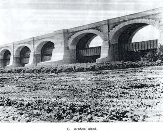
Operation Hydraulic Construction started 1923 Engineer Arnold Musto | Length Approximately 1 mile Opened 1932 First built 1932 | |
 | ||
Maintained by Sindh Irrigation & Power Department Latest built Rehabilitated in November 2004 Similar Ayub Bridge, Lansdowne Bridge Rohri, Chashma Barrage, Jinnah Barrage, Tarbela Dam | ||
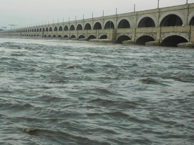
Flood in sukkur 04 sukkur barrage 10 8 2010 wmv
Sukkur Barrage (Urdu سكهر بئراج) is a barrage on the River Indus near the city of Sukkur in the Sindh province of Pakistan. The Barrage was built during the British Raj from 1923 to 1932 and was named Lloyd Barrage. The Sukkur Barrage, is the pride of Pakistan’s Irrigation system as it is the largest single Irrigation network of its kind in the world. It irrigates from Sukkur District in the North, to Mirpurkhas/ Tharparkar and Hyderabad districts in the South of Sindh, almost all parts of the Province except few. It is situated about 300 miles North East of Karachi, 3 miles below the Railway Bridge, or the Sukkur Gorge. The introduction of barrage-controlled irrigation system resulted in more timely water supplies for the existing cultivated areas of Sindh Province of Pakistan.
Contents
- Flood in sukkur 04 sukkur barrage 10 8 2010 wmv
- Sukkur flood situation at sukkur barrage 2 august
- History
- Functioning
- Wildlife
- References
Sukkur flood situation at sukkur barrage 2 august
History
Sindh survives almost entirely on the water of the River Indus as there is very limited groundwater available. Rainfall in the province averages between 100 and 200 mm per year, while the evaporation rate is between 1,000 and 2,000 mm. Thus, Sindh is arid and it is only the Indus which irrigates otherwise barren lands of Sindh. Regular surveys have not been carried out to assess the availability of groundwater in the province. Various sources estimate that its volume is between three and five MAF scattered in 28 per cent of the geographical area of Sindh. However, some experts suggest it to be less than these estimates. This water is found mainly along the Indus water channels and in the few natural underground streams.
The idea of Sukkur Barrage was conceived by Mr. C.A .Fife, in the year 1868, however, the project was finally sanctioned in 1923. It was constructed under the overall direction of Sir Charlton Harrison, CIE as chief engineer. While Sir Arnold Musto, CIE was the architect and engineer of the scheme. The Head Works and Canals were completed by 1932. On its completion it was opened by the Viceroy of India, Lord Willingdon. The scheme had been launched by the Governor of Bombay, Sir George Ambrose Lloyd (later known as Lord Lloyd) and it was named in his honour.
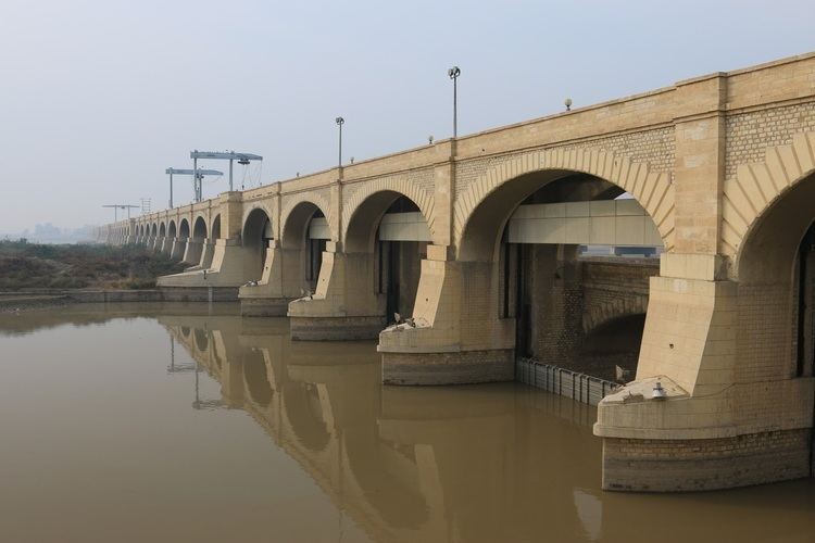
To revitalize its water storage capacity and distribution efficiency, the Government of Pakistan embarked upon a massive rehabilitation work of Sukkur Barrage. The work was started by Pakistan Army Engineering Corps and Frontier Works Organisation (FWO) on 22 November 2004, and was completed ahead of the deadline in July 2005, with the cost of just 15 million US$ (US Dollars). Experts believe that the rehabilitation of the barrage has enhanced its efficiency for another 60 to 70 years.
Functioning
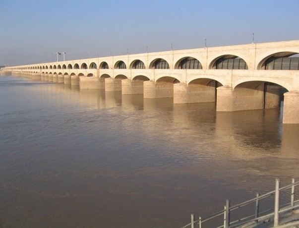
Sukkur Barrage is used to control water flow in the River Indus for the purposes of irrigation and flood control. This Barrage which is the backbone of the economy of the entire Country enables water to flow through what was originally a network of seven canals 6,166 miles (9,923 km) long, feeding the largest irrigation system in the world, with more than 7.63 million acres of irrigated land which forms approximately 25% of total canal irrigated area of the country. The retaining wall of the Barrage has 66 spans (outfall gates), each 60 feet (18 m) wide and weighing 50 tons.
The Nara canal which is one of the 7 Canals off taking from this Barrage is the longest canal of this country, carrying discharge almost equal to that of Thames River at London and its bed width which is 346 ft. is 1 ½ (one and half) times as big as of Suez Canal. In fact Nara Canal is not a man-made canal as it was the southernmost part of Hakro River which emanated from the foot hills of Sutlej which after traversing through the Punjab and Bhawalpur Plains joined Nara through Raini River, the remnants of which are still exiting in Ghotki Taluka. This Canal caters for an area of 2.3 million acres.
The next largest canal is Rohri Canal which though slightly shorter in length than Nara Canal is yet taking discharge much more than the former. It has cultivable area of 2.6 million acres settled for Irrigation. Cotton, wheat and sugar-cane are the main crops grown on this canal system. All the four canals on the left and two canals on the right bank of River Indus are perennial canals, delivering Irrigation supplies all the year round. The seventh canal namely, Rice Canal on the right side is a seasonal canal which flows only in Kharif Season and is designed for rice cultivation. The N.W. Canal on the right bank provides perennial Irrigation for an area of 965,000 (0.965 million) acres out of which 184,000 acres are situated in Baluchistan Province.
Wildlife
Indus River dolphins are occasionally seen upstream of the barrage.