
Country Thailand Time zone THA (UTC+7) Area 395.1 km² Province Ranong Province | Seat Kamphuan Postal code 85120 Population 11,046 (2005) Geocode 8505 | |
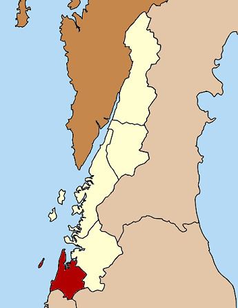 | ||
Suk Samran (Thai: สุขสำราญ) is a district (Amphoe) of Ranong Province, southern Thailand.
Contents
Map of Suk Samran District, Ranong, Thailand
History
The district was created on April 1, 1992 by splitting of the southern part of Kapoe district.
Following a decision of the Thai government on May 15, 2007, all of the 81 minor districts were to be upgraded to full districts. With the publishing in the Royal Gazette on August 24 the upgrade became official .
Geography
Neighboring districts are (from the north clockwise) Kapoe of Ranong Province, Ban Ta Khun of Surat Thani Province, and Khura Buri of Phang Nga Province. To the west is the Andaman Sea.
The eastern half of the district is part of the Khlong Nakha Wildlife Sanctuary.
Administration
The district is subdivided into 2 subdistricts (tambon), which are further subdivided into 13 villages (muban). There are no municipal (thesaban) areas, and further 2 Tambon administrative organizations (TAO).