Listing Hewitt Topo map OSi Discovery 74 Prominence 118 m | OSI/OSNI grid S039105 Elevation 663 m | |
 | ||
Similar Lyracappul, Fauscoum, Knockmealdown, Broaghnabinnia, Brassel Mountain | ||
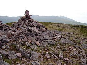
Sugarloaf Hill (Irish: Cnoc na Binne) is a mountain peak located in the Knockmealdown Mountains on the border between County Tipperary and County Waterford.
Map of Sugarloaf Hill, Bohernagore West, Co. Tipperary, Ireland
References
Sugarloaf Hill (Knockmealdowns) Wikipedia(Text) CC BY-SA
