
Country United States Zip Code 54235 Population 9,144 (2010) Number of airports 1 | Time zone Central (CST) (UTC-6) Website www.sturgeonbaywi.org Local time Wednesday 9:22 PM | |
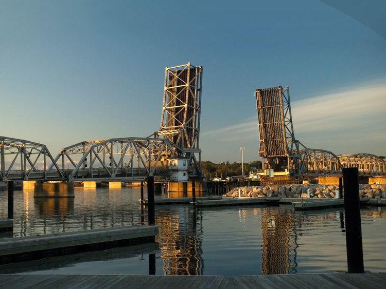 | ||
Weather 3°C, Wind NE at 10 km/h, 70% Humidity Area 30.2 km² (25.43 km² Land / 4.766 km² Water) Points of interest Potawatomi State Park, Sherwood Point Light, Sturgeon Bay Bridge, Door County Maritime, Sunset Park | ||
Tranquil timbers campground sturgeon bay wisconsin a tour with drivin vibin
Sturgeon Bay is a city in and the county seat of Door County, Wisconsin, United States. The population was 9,144 at the 2010 census. It is located at the natural end of Sturgeon Bay, although the Sturgeon Bay Ship Canal was built across the remainder of the Door Peninsula.
Contents
- Tranquil timbers campground sturgeon bay wisconsin a tour with drivin vibin
- Map of Sturgeon Bay WI 54235 USA
- Geography
- 2010 census
- 2000 census
- Municipal services
- Major highways
- Airport
- Education
- Entertainment
- References
Map of Sturgeon Bay, WI 54235, USA
Geography
Sturgeon Bay is located at 44°49′56″N 87°22′19″W (44.813376, -87.372076). According to the United States Census Bureau, the city has a total area of 11.66 square miles (30.20 km2), of which, 9.82 square miles (25.43 km2) is land and 1.84 square miles (4.77 km2) is water.
2010 census
As of the census of 2010, there were 9,144 people, 4,288 households and 2,385 families. The population density was 931.2 inhabitants per square mile (359.5/km2). There were 4,903 housing units at an average density of 499.3 per square mile (192.8/km2). The racial makeup of the city was 95.1% White, 1.0% African American, 0.9% Native American, 0.6% Asian, 1.0% from other races, and 1.4% from two or more races. Hispanic or Latino of any race were 2.7% of the population.
There were 4,288 households of which 24.3% had children under the age of 18 living with them, 42.5% were married couples living together, 9.7% had a female householder with no husband present, 3.5% had a male householder with no wife present, and 44.4% were non-families. 38.9% of all households were made up of individuals and 17.5% had someone living alone who was 65 years of age or older. The average household size was 2.07 and the average family size was 2.74.
The median age in the city was 45.2 years. 19.8% of residents were under the age of 18; 7.4% were between the ages of 18 and 24; 22.5% were from 25 to 44; 31% were from 45 to 64; and 19.2% were 65 years of age or older. The gender makeup of the city was 48.1% male and 51.9% female.
2000 census
As of the census of 2000, there were 9,437 people, 4,048 households, and 2,432 families residing in the city. The population density was 981.4 people per square mile (378.8/km²). There were 4,447 housing units at an average density of 462.5 per square mile (178.5/km²). The racial makeup of the city was 97.22% White, 0.33% Black or African American, 0.78% Native American, 0.37% Asian, 0.02% Pacific Islander, 0.46% from other races, and 0.82% from two or more races. 1.28% of the population were Hispanic or Latino of any race.
There were 4,048 households out of which 28.7% had children under the age of 18 living with them, 42.81% were married couples living together, 9.0% had a female householder with no husband present, and 39.9% were non-families. 35.0% of all households were made up of individuals and 15.8% had someone living alone who was 65 years of age or older. The average household size was 2.26 and the average family size was 2.92.
In the city, the population was spread out with 23.5% under the age of 18, 7.6% from 18 to 24, 26.6% from 25 to 44, 23.7% from 45 to 64, and 18.7% who were 65 years of age or older. The median age was 40 years. For every 100 females there were 92.4 males. For every 100 females age 18 and over, there were 88.0 males.
The median income for a household in the city was $31,935, and the median income for a family was $45,084. Males had a median income of $31,879 versus $21,414 for females. The per capita income for the city was $18,899. About 5.5% of families and 7.7% of the population were below the poverty line, including 11.2% of those under age 18 and 8.3% of those age 65 or over.
Municipal services
Major highways
Airport
Sturgeon Bay is served by Door County Cherryland Airport (IATA: SUE, ICAO: KSUE) which is off of Wisconsin Highway 42 and 57 on County Highway PD.
Education
The community is served by Sturgeon Bay High School and has a satellite campus of Northeast Wisconsin Technical College.
The city of Sturgeon Bay also has two elementary schools: Sawyer, and Sunrise. The middle school, T.J. Walker Middle School, is connected to the high school. An elementary school is operated by St. Peter's Evangelical Lutheran Church (WELS). Three former schools, Saint Peter and Paul, Corpus Christi, and Saint Joseph, have combined to form Saint John Bosco.
Entertainment
The community has one local movie theater, Sturgeon Bay Cinema 6, and two theaters, the Third Avenue Playhouse and The Depot PAC. Every year, the town hosts "Steel Bridge Songfest," where nationally known musicians perform. Past performers include Jackson Browne, Jane Wiedlin of the Go-Gos and Pat MacDonald of Timbuk3.