First documented 14th century Lowest elevation 410 m (1,350 ft) Area 17 km² Local time Thursday 12:34 AM | Highest elevation 630 m (2,070 ft) Postal code 512 33, 514 01 Population 1,830 (2009) Area code 481 | |
 | ||
Weather 9°C, Wind NW at 18 km/h, 86% Humidity | ||
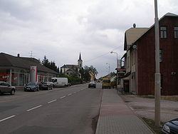
Studenec is a municipality in Semily District in the Liberec Region of the Czech Republic. It consists of two villages, Studenec and Zálesní Lhota. Studenec entered and won a medal in the Entente Florale in 2010
Contents
Map of Studenec, Czechia
References
Studenec (Semily District) Wikipedia(Text) CC BY-SA
