
Time zone CET (UTC+1) Area 8.89 km² | Established 14th century Postal code 41-301 | |
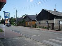 | ||
Strzemieszyce Małe – a district (dzielnica) of Dąbrowa Górnicza (since 1975) in the Silesian Voivodeship, Poland. Located between Strzemieszyce Wielkie and Łosień, 10.8 km eastwards from the town center, separated from Strzemieszyce Wielkie by the National Road . Before 1973 an independent rural commune (gmina).
Contents
Map of Strzemieszyce Ma%C5%82e, Dabrowa Gornicza, Poland
History
The first written record of the village name (in Latin Strmyeschycze minor) comes from the early 14th century. The village belonged along with Strzemieszyce Wielkie to the bishops of Kraków and was administered as part of the Sławków estates until 1790. An elementary school was established in 1820. In 1890 the village numbered 148 households. Two calamine mines ("Anna" and "Kawia Góra") operated here in the 19th century.
References
Strzemieszyce Małe Wikipedia(Text) CC BY-SA