
Easiest route Hike Prominence 294 m | Elevation 355 m Mountain range Olympic Mountains | |
 | ||
Similar Mount Storm King, Mount Angeles, Gold Mountain, Mount Townsend, Mount Constitution | ||
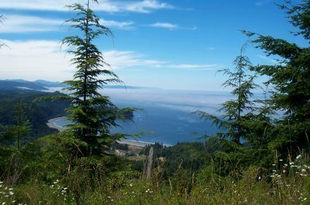
Striped Peak is a mountain located approximately 12 miles (19 km) west of Port Angeles, Washington. It is located directly off the Strait of Juan de Fuca and rises to 1,166 feet (355 m). The mountain used to be part of Camp Hayden, there are still accessible bunkers located on the mountain. To the east is located Freshwater Bay and to the west Crescent Bay. Also located to west is the Salt Creek Recreation Area and Tongue Point.
Map of Striped Peak, Washington 98363, USA
Striped Peak was named in 1846 by the British naval surveyor Henry Kellett due to a "landslip occurring down its face" (no longer visible).
Striped Peak has a variety of trails and roads that one can use to access points on the mountain. There a number of viewpoints which offer spectacular views of the strait, Victoria, British Columbia, Vancouver Island, Sooke, British Columbia, and surrounding coast and hills.