
Population 1,108 (2011) Sovereign state United Kingdom District Mendip | OS grid reference ST655505 Post town RADSTOCK Local time Wednesday 5:04 AM Dialling code 01761 | |
 | ||
Weather 10°C, Wind SW at 21 km/h, 93% Humidity | ||
Stratton-on-the-Fosse is a village and civil parish located on the edge of the Mendip Hills, 2 miles (3 km) south-west of Westfield, 6 miles (10 km) north-east of Shepton Mallet, and 9 miles (14 km) from Frome, in Somerset, England. It has a population 1,108, and has a rural agricultural landscape, although it was part of the once-thriving Somerset coalfield. Within the boundaries of the parish are the hamlets of Benter and Nettlebridge.
Contents
- Map of Stratton on the Fosse Radstock UK
- History
- Governance
- Geography
- Landmarks
- Religious sites
- References
Map of Stratton-on-the-Fosse, Radstock, UK
Stratton-on-the-Fosse straddles the Fosse Way, an ancient Roman road which linked the cities of Lincoln and Exeter. It lies between the city of Bath and the town of Shepton Mallet.
St Vigor and St John Church of England Primary School is situated in nearby Chilcompton.
History
There is evidence of human occupation of the area since the Bronze Age with skeletons and pottery being found in local caves. Blacker's Hill is believed to be an Iron Age camp occupied by the Belgae in the later Iron Age with the Romans later occupying it.
The parish of Stratton-on-the-Fosse was part of the Kilmersdon Hundred,
The manor was given to Glastonbury Abbey by King Edgar the Peaceful and during the time of Edward the Confessor was let by the abbey to a Saxon thane named Alwold. After the Norman Conquest William the Conqueror took many lands, including Stratton-on-the-Fosse, from the abbey and gave them to Geoffrey de Montbray the Bishop of Coutances. The manor later passed to the Gourney family. Sir Thomas de Gournay was concerned in the murder of Edward II at Berkeley Castle, for which his estates were confiscated, and Stratton was later annexed to the Duchy of Cornwall.
Land just south of Benter Cross which contains the remains of coal mines from around 1700 is owned by the Somerset Wildlife Trust to be managed for grassland species. Benter House is a small country house dating from 1829. It has been designated by English Heritage as a Grade II listed building.
The site of the current Nettlebridge House was formerly two cottages, with an attached workshop formerly used as a brewery and stocking factory. All were owned by the Duchy of Cornwall, as were the majority of the houses in Nettlebridge. One of the cottages was demolished in 1965. The former stocking factory was converted to be an occasional part of the main house in 2004. There is an active spring under the kitchen floor.
Coal mining on the Somerset coalfield was a major industry but all mines have now closed.
The public school of Downside Abbey, which moved to the village in 1814, is a keypoint of the local economy. Otherwise, Stratton-on-the-Fosse is now largely a dormitory town for larger towns and cities such as Bath and Bristol.
Governance
The parish council has responsibility for local issues, including setting an annual precept (local rate) to cover the council’s operating costs and producing annual accounts for public scrutiny. The parish council evaluates local planning applications and works with the local police, district council officers, and neighbourhood watch groups on matters of crime, security, and traffic. The parish council's role also includes initiating projects for the maintenance and repair of parish facilities, as well as consulting with the district council on the maintenance, repair, and improvement of highways, drainage, footpaths, public transport, and street cleaning. Conservation matters (including trees and listed buildings) and environmental issues are also the responsibility of the council.
The village falls within the Non-metropolitan district of Mendip, which was formed on 1 April 1974 under the Local Government Act 1972, having previously been part of Shepton Mallet Rural District, which is responsible for local planning and building control, local roads, council housing, environmental health, markets and fairs, refuse collection and recycling, cemeteries and crematoria, leisure services, parks, and tourism.
Somerset County Council is responsible for running the largest and most expensive local services such as education, social services, libraries, main roads, public transport, policing and fire services, trading standards, waste disposal and strategic planning.
It is also part of the Somerton and Frome county constituency represented in the House of Commons of the Parliament of the United Kingdom. It elects one Member of Parliament (MP) by the first past the post system of election, and part of the South West England constituency of the European Parliament which elects seven MEPs using the d'Hondt method of party-list proportional representation.
Geography
Very close to Nettlebridge is the ancient Harridge Wood, which is in the care of the Somerset Wildlife Trust. It comprises five sites with a total area of 54 ha (133 acres). It forms a major element of the Mells Valley Prime Biodiversity Area.
Landmarks
Hillside House in Nettlebridge, a former pub, is a Grade II listed building.
Religious sites
The abbey church of St Gregory the Great, which is known as Downside Abbey church, is an example of neo-gothic architecture. It dominates the village with its 55 metres (180 ft) tower, and is a Grade I listed building. Downside School, which has grown in conjunction with the abbey, is a Roman Catholic Public School. There is also a catholic church in the village which is dedicated to St Benedict and opened in 1857.
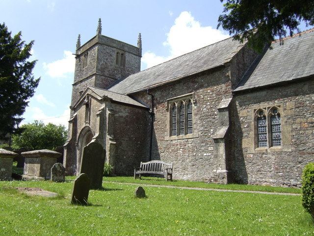
The Anglican Church of St. Vigor dates from the 12th century and is also Grade I listed.