
Country United States County Tulare FIPS code 06-75280 Elevation 122 m Zip code 93267 Area code Area code 559 | Time zone Pacific (PST) (UTC-8) GNIS feature ID 1652797 Area 3.675 km² Population 2,819 (2010) | |
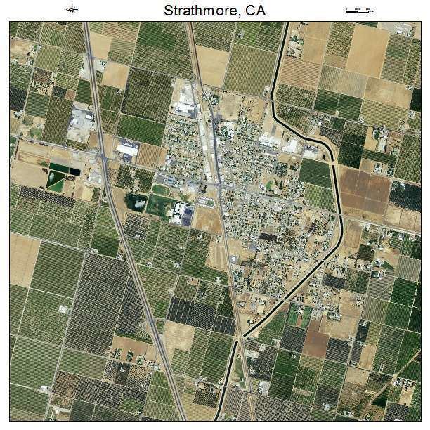 | ||
Strathmore is a census-designated place (CDP) in Tulare County, California, United States. The population was 2,819 at the 2010 census, up from 2,584 at the 2000 census.
Contents
Map of Strathmore, CA 93267, USA
Geography
Strathmore is located at 36°8′42″N 119°3′34″W (36.144891, -119.059506).
According to the United States Census Bureau, the CDP has a total area of 1.4 square miles (3.6 km2), of which, 1.4 square miles (3.6 km2) of it is land and 0.92% is water.
Climate
According to the Köppen Climate Classification system, Strathmore has a semi-arid climate, abbreviated "BSk" on climate maps.
2010
The 2010 United States Census reported that Strathmore had a population of 2,819. The population density was 1,986.0 people per square mile (766.8/km²). The racial makeup of Strathmore was 1,490 (52.9%) White, 12 (0.4%) African American, 41 (1.5%) Native American, 7 (0.2%) Asian, 1 (0.0%) Pacific Islander, 1,162 (41.2%) from other races, and 106 (3.8%) from two or more races. Hispanic or Latino of any race were 2,238 persons (79.4%).
The Census reported that 2,819 people (100% of the population) lived in households, 0 (0%) lived in non-institutionalized group quarters, and 0 (0%) were institutionalized.
There were 705 households, out of which 422 (59.9%) had children under the age of 18 living in them, 411 (58.3%) were opposite-sex married couples living together, 130 (18.4%) had a female householder with no husband present, 54 (7.7%) had a male householder with no wife present. There were 51 (7.2%) unmarried opposite-sex partnerships, and 4 (0.6%) same-sex married couples or partnerships. 93 households (13.2%) were made up of individuals and 40 (5.7%) had someone living alone who was 65 years of age or older. The average household size was 4.00. There were 595 families (84.4% of all households); the average family size was 4.35.
The population was spread out with 1,051 people (37.3%) under the age of 18, 340 people (12.1%) aged 18 to 24, 696 people (24.7%) aged 25 to 44, 531 people (18.8%) aged 45 to 64, and 201 people (7.1%) who were 65 years of age or older. The median age was 25.5 years. For every 100 females there were 99.6 males. For every 100 females age 18 and over, there were 101.1 males.
There were 751 housing units at an average density of 529.1 per square mile (204.3/km²), of which 366 (51.9%) were owner-occupied, and 339 (48.1%) were occupied by renters. The homeowner vacancy rate was 1.9%; the rental vacancy rate was 6.4%. 1,475 people (52.3% of the population) lived in owner-occupied housing units and 1,344 people (47.7%) lived in rental housing units.
2000
As of the census of 2000, there were 2,584 people, 678 households, and 551 families residing in the CDP. The population density was 1,838.5 people per square mile (707.6/km²). There were 743 housing units at an average density of 528.6 per square mile (203.5/km²). The racial makeup of the CDP was 45.47% White, 0.23% African American, 1.08% Native American, 1.39% Asian, 47.64% from other races, and 4.18% from two or more races. Hispanic or Latino of any race were 68.54% of the population.
There were 678 households out of which 51.2% had children under the age of 18 living with them, 60.2% were married couples living together, 15.9% had a female householder with no husband present, and 18.7% were non-families. 15.9% of all households were made up of individuals and 8.7% had someone living alone who was 65 years of age or older. The average household size was 3.81 and the average family size was 4.25.
In the CDP, the population was spread out with 38.5% under the age of 18, 12.6% from 18 to 24, 26.0% from 25 to 44, 15.9% from 45 to 64, and 6.9% who were 65 years of age or older. The median age was 24 years. For every 100 females there were 102.0 males. For every 100 females age 18 and over, there were 98.3 males.
The median income for a household in the CDP was $25,156, and the median income for a family was $27,917. Males had a median income of $22,188 versus $19,542 for females. The per capita income for the CDP was $8,128. About 24.2% of families and 30.4% of the population were below the poverty line, including 41.3% of those under age 18 and 21.5% of those age 65 or over.
Politics
In the state legislature Strathmore is located in the 18th Senate District, represented by Republican Roy Ashburn, and in the 34th Assembly District, represented by Republican Bill Maze.
In the United States House of Representatives, Strathmore is in California's 23rd congressional district, represented by Republican Kevin McCarthy