
Population 110 (township) (2006) Time zone AEST (UTC+10) Postal code 2422 | Postcode(s) 2422 LGA(s) Mid-Coast Council Elevation 130 m | |
 | ||
Location 249 km (155 mi) N of Sydney13.6 km (8 mi) S of Gloucester109 km (68 mi) N of Newcastle66.3 km (41 mi) N of Pacific Highway | ||
Stratford is a rural locality in the Mid-Coast Council local government area in the Hunter Region of New South Wales, Australia. The largest population centre in the area is the town of Stratford, which is approximately 14 kilometres (9 mi) south of Gloucester and 109 km (68 mi) north of Newcastle. Stratford, which is next to the Avon River, is on Bucketts Way, 66 km (41 mi) from the Pacific Highway, the nearest major highway.
Map of Stratford NSW 2422, Australia
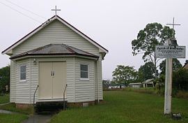
At the 2006 census, the village of Stratford had a population of 110. The village has a park with cricket pitch and play-gym, a New South Wales Rural Fire Service shed, shop with petroleum, hall, church, public school and the Stratford lawn cemetery. The village is located on one of the main access routes to the Barrington Tops National Park.
The principal industries of the area include mining, beef cattle breeding and dairying. The nearby Stratford coal mine transports coal to Newcastle for export or the New South Wales Power Stations.