
Time zone CET/CEST (UTC+1/+2) Area 13.78 km² Postal code 06493 Dialling code 039489 | Elevation 399 m (1,309 ft) Postal codes 06493 Local time Wednesday 7:19 AM | |
 | ||
Weather 8°C, Wind W at 18 km/h, 76% Humidity | ||
Straßberg is a village and a former municipality in the district of Harz, Saxony-Anhalt, Germany. Since 1 August 2009, it is part of the town Harzgerode. Straßberg is located in southeastern part of the Harz mountains, 20 km south of Quedlinburg, 22 km northeast of Nordhausen and 23 km northwest of Sangerhausen.
Contents
Map of Stra%C3%9Fberg, Germany
History
Straßberg was mentioned for the first time in the chronicle for the district of Sangerhausen in 1194 as Strazberc.
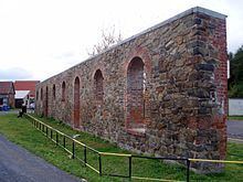
From 1400 mining became the main livelihood for the villagers of Straßberg. Today, they preserve its mining history and look after their history and conserve the village for those seeking relaxation the past. Even agriculture flourishes despite the rather difficult natural environment.
On 1 August 2009 the municipality of Straßberg agreed with the towns of Güntersberge and Harzgerode as well as the villages of Dankerode, Königerode, Schielo and Siptenfelde to be incorporated into the new borough of Harzgerode.
Museums
Straßberg bears witness today to the historic silver and fluorspar mines, old shafts, sinkholes (Pingen) and technical facilities: