Girish Mahajan (Editor)

Storžič

Updated on
Edit
Like
Comment
Share on FacebookTweet on TwitterShare on LinkedInShare on Reddit
Elevation
  
2,132 m

Mountain range
  
Kamnik–Savinja Alps, Alps

Parent range
  
Kamnik–Savinja Alps

Storžič wwwsummitpostorgimagesoriginal13464JPG

Similar
  
Grintovec, Tolsti vrh, Begunjščica, Stol, Ratitovec

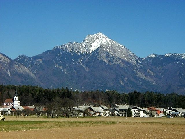
Storžič ([ˈstɔːɾʒitʃ]; 2132 m) is the highest mountain in the western part of the Kamnik–Savinja Alps. The top is a nicely shaped cone (Slovene: storž), from which the mountain got its name. Storžič has a good panoramic view. To the south are the Ljubljana Basin, Mount Krim, the Javornik Hills, Mount Snežnik, the Nanos Plateau, and the Škofja Loka Hills. To the west are the Julian Alps with prominent Mount Triglav. To the north are the Karawanks with Mount Stol, Mount Begunjščica, and Mount Košuta. To the east are the Jezersko Cirque, Mount Grintovec, the Kalce Ridge and Mount Krvavec.

Contents

Map of Stor%C5%BEic, 4290 Tr%C5%BEi%C4%8D, Slovenia

Starting points

  • Bašelj (Preddvor)
  • Gozd (Tržič)
  • Lom pod Storžičem (Tržič)
  • Preddvor
  • Spodnje Jezersko (Jezersko)
  • Trstenik (Kranj)
  • Routes

  • 4 h: from the Storžič Lodge (Slovene: Dom pod Storžičem, 1,123 m), over Male Poljane via Psico
  • 3½ h: from the Storžič Lodge (1,123 m), over Škarjeve peči
  • 3 h: from the Storžič Lodge (1,123 m), through Žrelo, over Transverzala
  • 1¾ h: from Planinski dom na Kališču hut (1534 m), over Transverzala
  • 4½ h: from Zavetišče v Gozdu hut (891 m), passing Mala Poljana
  • 4½ h: from Spodnje Jezersko, over Bašeljski vrh
  • 3½ h: from Trstenik, passing Velika Poljana or Javornik
  • 3 h: from Bašelj, passing Koče nad Malo Pečjo over ridge on an unnmarked route
  • References

    Storžič Wikipedia


    Similar Topics