
OS grid NY348093 Elevation 503 m | Topo map OS Explorer OL5, OL7 Prominence 2 m | |
 | ||
Similar | ||
Stone Arthur is a fell in the English Lake District, an outlier of the Fairfield group in the Eastern Fells. It stands above Grasmere village.
Contents
Map of Stone Arthur, Ambleside, UK
TopographyEdit
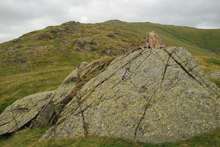
Stone Arthur is properly the south western ridge of Great Rigg, but was given the status of a separate fell by Alfred Wainwright in his Pictorial Guide to the Lakeland Fells and that convention is followed here. His decision was based on it having a summit tor with"a short wall of rock like a ruined castle.". This outcrop appears particularly impressive from Grasmere village, from where the higher fells are hidden.
From the top of Great Rigg the main ridge ploughs on due south, descending over the tops of Heron Pike and Nab Scar and carrying the ever popular Fairfield horseshoe walk. A second shorter ridge descends steadily to the south west over gradually roughening ground, until after three quarters of a mile a rock outcrop is thrust up. This is Arthur's Chair and the ridge upon which it stands is Stone Arthur. Prominence is negligible, and other than the low outcrop itself, the "summit" is merely the point at which the gradient steepens markedly.
Between Stone Arthur and Heron Pike is the little valley of Greenhead Gill. This bears evidence of former mining activities, beginning at around 600 ft above sea level with a trial. Further up the fellside are the remains of Grasmere Lead Mine. This was operated by the Mines Royal between 1564 and 1573 and there are several levels and shafts around the 1,000 ft contour.
To the north west of Stone Arthur is the valley of Tongue Gill, separating it from the lower slopes of Seat Sandal. This side of the ridge is craggy with the main features being Brackenwife Knotts and Rigg Crags. Both Tongue and Greenhead Gills are tributaries of the River Rothay, which passes through Grasmere village to the lake of Grasmere. The lower slopes have been planted with areas of woodland.
GeologyEdit
The summit tor is an example of the pebbly sandstone and breccia of the Pavey Ark Member.
SummitEdit
The summit of Stone Arthur is difficult to locate exactly amongst the upthrust rocks of Arthur's Chair. The view is excellent, particularly over Grasmere with Easedale Tarn showing across the valley.
AscentsEdit
Stone Arthur can be climbed directly up the steep ridge from the village, although the depth of bracken combined with the gradient do not make the prospect particularly alluring. The summit can also be reached from either side of the ridge. Beginning at Mill Bridge, Tongue Gill can be followed until the footbridge, before making a pathless ascent on grass. From Grasmere, Greenhead Gill also provides access, climbing until a contouring traverse to the summit can be made.