
Surface area 34.86 km (13.46 sq mi) Surface elevation 1,090 m Shore length 124.6 km | References NVE Area 34.86 km² | |
 | ||
Reference Norwegian Water Resources and Energy Directorate | ||
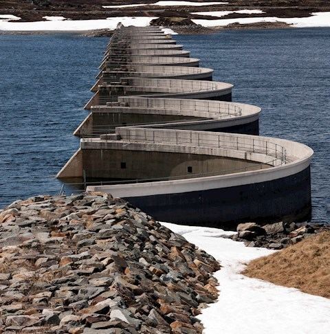
Stolsvatnet is a regulated lake in the municipalities of Ål and Hol in Buskerud county, Norway. Stolsvatnet was formed in the late 1940s by the damming of the upper parts of three rivers, (Stolsvatn, Olsendvatn, Holselva) which created a continuous lake across the watersheds. The new lake covered a number of existing smaller lakes. It is a reservoir for Hol I kraftverk, a hydroelectric power plant located off FV 50 by Hovet in Hol. The power plant is owned and operated by E-Co Energi.
Map of Stolsvatnet, 3577 Hovet, Norway
References
Stolsvatnet Wikipedia(Text) CC BY-SA