OS grid reference TF174659 Post town WOODHALL SPA Dialling code 01526 | Sovereign state United Kingdom Postcode district LN10 Civil parish Stixwould and Woodhall | |
 | ||
Stixwould is a small village in the civil parish of Stixwould and Woodhall (where the population is included) , in the East Lindsey district of Lincolnshire, England. It is situated 13 miles (21 km) east from Lincoln and 2 miles (3.2 km) north-east from the large village of Woodhall Spa. The River Witham runs a little over a mile to the west of the village which lies on the southern end of the Lincolnshire Limewoods.
Contents
Map of Stixwould, Woodhall Spa, UK
Church
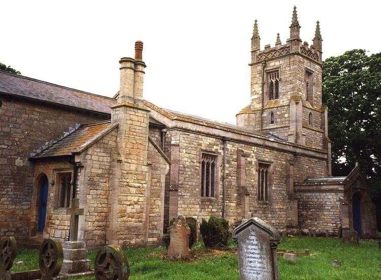
The parish church is a Grade II listed building dedicated to Saint Peter, rebuilt in 1831 by Christopher Turner. The font dates from the 16th century. A 13th-century grave slab, found on the site of Stixwould Abbey, leans against north side of the church tower. There is also a 14th-century churchyard cross in the graveyard.
Railway
In 1846 the Great Northern railway company purchased the land to build a 58 miles (93 km) rail link from Peterborough to Lincoln along the banks of the River Witham. Works commenced in 1847 and the line opened on 17 October 1848 along with Stixwould station one mile to the west of the village. The station was closed on 5 October 1970 and the station building is now a private residence. The Water Rail Way, part of the National Cycle Network (Route 1) managed by Sustrans, now runs along the course of the tracks.
