
Area 1,159 km² Established 1957 | ||
 | ||
Managing authorities Website Stirling Range National Park | ||
Stirling Range National Park is a national park in the Great Southern region of Western Australia, approximately 337 km south-east of Perth.
Contents
- Map of Stirling Range National Park WA 6338 Australia
- Our team climbing the mount bluff knoll stirling range national park
- Description
- Environment
- References
Map of Stirling Range National Park WA 6338, Australia
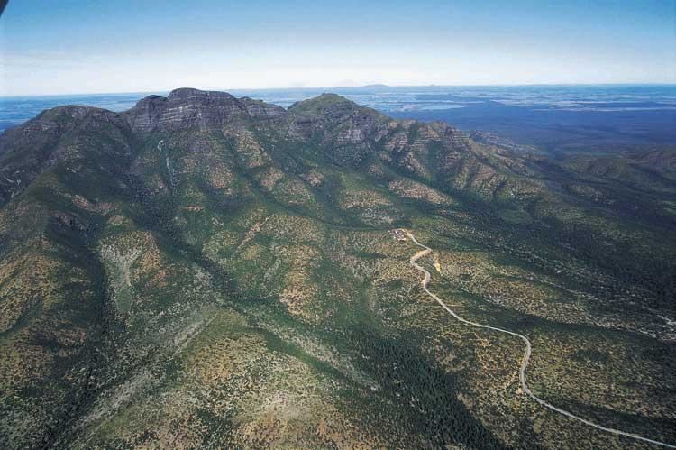
Our team climbing the mount bluff knoll stirling range national park
Description
It protects the Stirling Ranges, or Koikyennuruff, a range of mountains and hills over 60 km wide from west to east, stretching from the highway between Mount Barker and Cranbrook eastward past Gnowangerup. Notable features include Toolbrunup, Bluff Knoll - the tallest peak in the southwestern region, and a silhouette called The Sleeping Princess which is visible from the Porongurup Range. Popular recreational activities in the park include bushwalking, abseiling and gliding. Camping is permitted only in Moingup campsite within the park boundaries (fee applies).
Environment
The park has been identified by BirdLife International as an Important Bird Area (IBA) because it supports populations of endangered short-billed black cockatoos and western whipbirds, and is visited by endangered long-billed black-cockatoos.