
Etymology Philip Stephens Archipelago Torres Strait Islands State Queensland Adjacent body of water Torres Strait | Location Northern Australia Adjacent bodies of water Torres Strait Island group Torres Strait Islands | |
 | ||
Local government area Torres Strait Island Region | ||
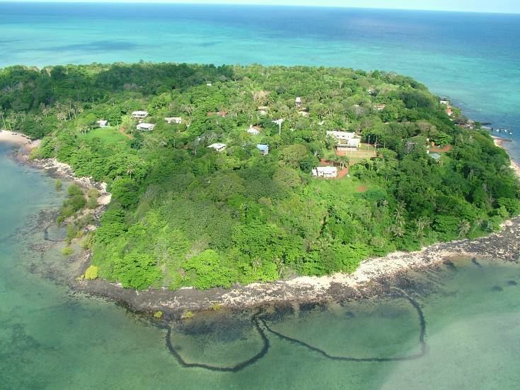
Stephens Island, called Ugar in the native language, is an island of the Torres Strait Islands archipelago, located in the eastern section of Torres Strait, Queensland, Australia. The island is administratively managed by the local government area of the Torres Strait Island Region.
Contents
Geography
The island is located near the Great Barrier Reef and north of Coconut Island (also called Poruma) and northwest of Murray Island, Torres Strait and west of Darnley Island.
Islanders
The people of Stephens Island call themselves Ugarem Le, and are the same people as the neighbouring Erubam Le of Erub (Darnley Island), the Meriam Le and Nog Le of Mer (Murray), the Dauarab Le of Dauar and the people of Waier. The traditional language of these islands is Meriam Mìr, of which there were formerly two dialects, Erub-Ugar and Mer-Dauar-Waier.
Etymology
The island's European name was bestowed by Captain William Bligh in 1792 during his second breadfruit voyage to the Pacific, after Philip Stephens, First Secretary to the Admiralty.