
Area rank 93rd of 105 Lowest elevation 288 m (945 ft) Area 12.16 km² Lau 2 09011 | Canton Capellen Highest elevation 349 m (1,145 ft) Time zone CET (UTC+1) Local time Monday 9:32 AM Team SC Steinfort | |
 | ||
Weather 8°C, Wind NE at 14 km/h, 57% Humidity | ||
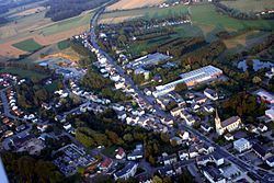
Steinfort (Luxembourgish: Stengefort) is a commune and town in western Luxembourg. It is part of the canton of Capellen, which is part of the district of Luxembourg.
Contents
Map of Steinfort, Luxembourg
As of 2005, the town of Steinfort, which lies in the north of the commune, has a population of 2,184. Other towns within the commune include Hagen, Kleinbettingen and Grass.
Road
Steinfort lies at the Belgian/Luxembourg border on the Route d'Arlon, the original road linking Luxembourg City to Arlon.
Rail
Steinfort was served by a railway that stretched from Pétange to Ettelbruck in the north of the country. Despite the line's closure in 1967, the rails were never lifted and old rail infrastructure is still visible through Steinfort, where it crosses Route D'Arlon at a level crossing.
Nearest railway stations: