
Country Pakistan Union Council Steel Town (U.C.20) Postal code 75200 | Time zone PST (UTC+05:00) Population 25,000 (2015) | |
 | ||
Steel Town is an 8,126-acre (3,288 ha) residential area for employees of Pakistan Steel Mills, with subsidised rents for essential employees. It is located on the edge of the N-5 National Highway that leads to Thatta from Karachi. Steel Town is about 40 kilometres (25 mi) from Karachi.
Map of Pakistan Steel Town, Karachi, Pakistan
The neighbouring areas include Pipri, Shah Latif Town, and Gulshan-e-Hadeed.
There are several ethnic groups living at Steel Town, Majority Sindhi Peoples living at Town. which include Others ethnic Punjabis, Muhajirs, Kashmiris, Seraikis, Pakhtuns, Balochis, Memons, Bohras and Ismailis etc.
Steel Town has all the features of an advanced system of living. Pakistan Steel Hospital, previously Hundred Bed Hospital has been providing medical facilities to the employees of Pakistan Steel Mills.
There are several Schools and colleges in Steel Town. Beaconhouse school Steel town Branch and Pakistan Steel Cadet College is located in Steel Town.
Near Cadet College there is a Cricket Stadium, Hockey Stadium and a football ground.
Officers' Club is a place for all social and cultural activities. For shopping there is Pakistani Market and a similar Russian Market in Russian blocks.
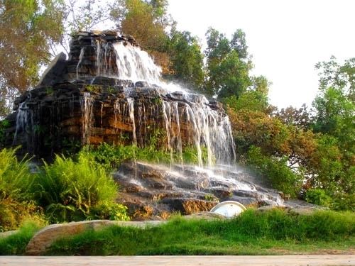
Quaid-e-Azam Park is located in Steel Town, it is a worth visiting beautiful park. On holidays people of localities as well as from all over Karachi city arrange picnics to visit this place and enjoy leisure time.
Steel Town Police Station, Utility Stores, the residency of the Chairman of Pakistan Steel Mills and a public Library are located near Quaid-e-Azam Park.