
Country United States Time zone Central (CST) (UTC-6) GNIS feature ID 1271280 Local time Sunday 2:38 PM | GNIS feature ID 504285 Elevation 306 m | |
 | ||
Counties Clinton, KY and Pickett, TN Weather 18°C, Wind SW at 18 km/h, 84% Humidity | ||
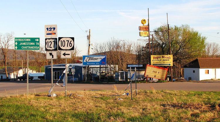
Static is an unincorporated community in Clinton County, Kentucky, and Pickett County, Tennessee, in the southeastern United States. It is located on the Tennessee–Kentucky state line south of Albany, Kentucky, northwest of Jamestown, Tennessee and north of Byrdstown, Tennessee.
Contents
Map of Static, KY 42602, USA
According to tradition, Static has the name of a settler's dog. Static has been noted for its unusual place name.
Geography
Static is located at a crossroads intersection involving U.S. Route 127 (US 127), Tennessee State Route 111 (TN 111) (formerly Tennessee State Route 42), and Kentucky Route 1076. Its coordinates are 36°37′19″N latitude, and 85°5′6″W longitude. Using US 127, Jamestown, Tennessee, is 21 miles (33.8 km) southeast, and Albany, Kentucky, is six miles north. Byrdstown, Tennessee, however, is 6 miles (9.65 km) southwest via TN 111.
The town is located due east of the Dale Hollow Lake area.
Education
In terms of public schools, the Kentucky side of the Static area attends Clinton County Schools based in Albany, while students on the Tennessee side attend the small Pickett County Public Schools system.