
Country United States GNIS feature ID 1303808 Local time Sunday 2:06 PM | Time zone Central (CST) (UTC-6) Elevation 220 m Area code 615 | |
 | ||
Weather 21°C, Wind S at 24 km/h, 71% Humidity | ||
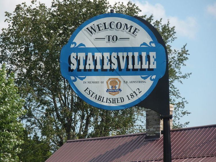
Statesville is an unincorporated community in Wilson County, Tennessee. It is located along Tennessee State Route 267.
Contents
Map of Statesville, TN 37184, USA
History
The community was first called Smith's Fork and was officially established in 1812, making it the second oldest town in Wilson County. Local resident William Bumpass donated land to be divided into 19 town lots. The community was originally named "Marysville" in honor of Mary Bumpass, William's wife. In 1818 the community applied for a post office. To avoid confusion with Maryville in east Tennessee, the town's name was changed to Statesville, chosen in honor of Statesville, North Carolina, as many residents had come from that location.
The post office was established on March 29, 1819, and was twice discontinued before closing in 1935. The town became prominent in 1834 when one-fourth of the state's cotton mills were located there. During that time there were seven stores, five saloons, a wood shop, three blacksmith shops, and three harness, boot, and shoe shops.