
Length 24.2 km | ||
 | ||
State Highway 11 (SH 11) is a State Highway in Kerala, India that starts in Kalarcode, Alappuzha and ends in Perunnai, Changanassery.The road is popularly known as AC road (Alappuzha Changanassery) road. The highway is 24.2 km long.
Contents
Map of SH11, Kerala
About the road
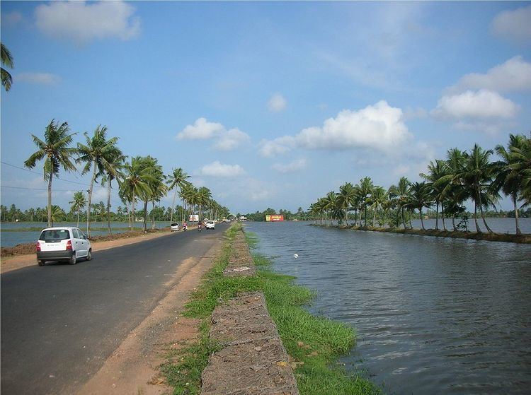
The Alappuzha-Changanassery Road was opened for traffic in 1958.The road has been constructed parallel to the AC (Alappuzha -Changanassery) canal which is man made.The A-C canal, which runs along the length of the road is meant to empty the flood waters of upper Kuttanad into the Nedumudy lake and the Pallathuruthy lake near Alappuzha.
The Route Map
(starts from NH-47(NH-66 now), at Kalarcode) Alappuzha - Kainakary - Nedumudi - Ramankary -Kidangara - Changanassery (joins MC Road at Perunna)
Significance
AC Road is the first road which is passing though Kuttanad Paddy fields. The road passes through scenic paddy fields,coconut groves in Kuttanad and backwaters in Alappuzha.
Survelliance
The Motor Vehicles Department, in partnership with the Kerala Road Safety Authority (KRSA) and the police has installed automatic traffic enforcement camera systems in between various points of Changanassery - Alappuzha section of AC road for detecting speed violations of vehicles.
Flooding in AC road
The AC road is prone to flooding during monsoon seasons in Kerala. As the road mostly passes through low-lying areas of Kuttanad, the road traffic is affected during heavy rains as parts of the road will be submerged in flood waters from Kuttanad.