
Country Canada Census division No. 5 Incorporated 1912 Population 2,066 (2016) Province Alberta | Region Southern Alberta Established 1943 Time zone MST (UTC-7) | |
 | ||
Starland County is a municipal district located in southern Alberta Canada.
Contents
Map of Starland County, AB, Canada
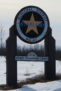
The municipality was incorporated in 1912, and established in the current boundaries in 1943, under the name Municipal District of Morrin No. 277. The name was changed the same year to Municipal District of Starland No. 277. Its name was changed again to Starland County in 1998.
Demographics
In the 2016 Census of Population conducted by Statistics Canada, Starland County recorded a population of 2,066 living in 611 of its 693 total private dwellings, a 6999400000000000000♠0.4% change from its 2011 population of 2,057. With a land area of 2,559.95 km2 (988.40 sq mi), it had a population density of 0.8/km2 (2.1/sq mi) in 2016.
Starland County's 2013 municipal census counted a population of 2,071.
In the 2011 Census, Starland County had a population of 2,057 living in 586 of its 664 total dwellings, a -13.2% change from its 2006 population of 2,371. With a land area of 2,557.7 km2 (987.5 sq mi), it had a population density of 0.8/km2 (2.1/sq mi) in 2011.
In 2006, Starland County had a population of 2,371 living in 748 dwellings, a 7.3% increase from 2001. The municipal district has a land area of 2,557.70 km2 (987.53 sq mi) and a population density of 0.9/km2 (2.3/sq mi).
Its population as of 2001 was 2,210.