
Population 303 (2011 census) Postal code 4702 | Postcode(s) 4702 Stanwell KabraBouldercombe Local time Sunday 11:23 AM | |
 | ||
Weather 28°C, Wind SE at 21 km/h, 72% Humidity | ||
Stanwell is a town and rural locality in the Rockhampton Region, Queensland, Australia. In the 2011 census, Stanwell had a population of 303 people.
Contents
Map of Stanwell QLD 4702, Australia
Geography
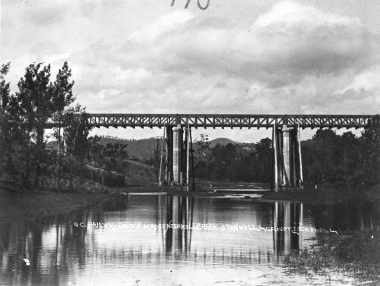
Stanwell is located on the Capricorn Highway and the Central Western railway line. Neerkol Creek flows past the town.
History
Early settlers in the Stanwell area were involved in dairying, quarrying or working for the railways.
Stanwell State School opened on 7 November 1873.
A postal receiving office opened in about 1874; a post office opened on 1 October 1880.
In 1893, a quarry leased by Bishop John Cani was used to provide sandstone for the construction of St Josephs Roman Catholic Cathedral in Rockhampton.
An honour board was erected in the School of Arts Hall to honour those who served in World War I and World War II.
Construction of the Stanwell Power Station commenced in 1993 and it became operational in 1996.
Economy
The Stanwell Power Station is located in Stanwell. It is located on 1,600 hectares (4,000 acres) of land to the south-west of the town.
Education
Stanwell State School is a government primary (P-7) school located at 20 Teakle Street (23.484438°S 150.32029°E / -23.484438; 150.32029 (Stanwell State School)). In 2012, the school had an enrolment of 38 students with 3 teachers (2.5 full-time equivalent). The school motto is 'Study, service, sincerity'.