
Population 490 (2014 census) Postal code 3623 Federal division Division of Murray | Postcode(s) 3623 Local time Sunday 8:48 AM | |
 | ||
Location 197 km (122 mi) N of Melbourne42 km (26 mi) W of Shepparton22 km (14 mi) S of Kyabram Weather 19°C, Wind E at 8 km/h, 82% Humidity | ||
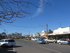
Stanhope is a small town in north central Victoria, Australia. Stanhope is 42 kilometres (26 mi) from Shepparton. It lies 197 kilometres (122 mi) north of the state capital Melbourne and 567 kilometres (352 mi) south west of Canberra the capital city of Australia. At the 2014 census, Stanhope had a population of 490.
Contents
Map of Stanhope VIC 3623, Australia
History
The Post Office opened on 21 May 1917 but was known as Lauderdale until 1920.
Today
Like many towns in this area of Victoria it relies heavily on its fruit production, food processing and farming and a large food processing plant lies in the centre of the town.
Like much of Victoria Netball and Australian rules football are extremely popular and Stanhope hosts a team which is part of the Kyabram & District Football League.
Services in the town include a general convenience store, a wine bar, a pub, lawn bowls and tennis courts.
Local landmarks include Lake Cooper and Loch Garry and other towns nearby include Girgarre East and Tatura and Echuca.
Notable people
John McEwen, a.k.a. "Black Jack McEwen", 18th Prime Minister of Australia, was a dairy farmer in Stanhope before entering politics.