
Primary inflows Catchment area 80.66 km (31.14 sq mi) Area 7.66 km² Shore length 19.31 km Inflow source Ach | Primary outflows River Ach Basin countries Germany Surface elevation 649 m Mean depth 9.8 m Cities Seehausen am Staffelsee | |
 | ||
Max. length 9.575 kilometres (5.950 mi) Similar Murnauer Moos, Kochelsee, Walchensee, Alps, Lake Starnberg | ||
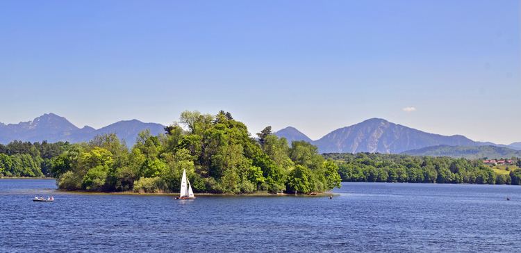
The Staffelsee is a lake in the Garmisch-Partenkirchen district of Bavaria, Germany. The settlements of Murnau, Seehausen and Uffing lie on its shores. Within its 7 km2 (2.7 sq mi) area lie seven major islands, the largest of which is Wörth. Boat trips aboard the MS Seehausen (built 2009) connect the landing stages of Seehausen, Uffing and Achele (Murnau) between April and October. The surface of the lake is, on average, 649 metres (2,129 ft) above sea level, and at its deepest it is around 40 metres (130 ft) deep.
Map of Staffelsee, 82418 Seehausen am Staffelsee, Germany
The main inflow and outflow of the lake is the River Ach, which enters from the west and departs to the north.
References
Staffelsee Wikipedia(Text) CC BY-SA