Basin size 993 sq mi (2,570 km) Basin area 2,572 km² | Length 52 km | |
Main source Confluence of North St. Vrain and South St. Vrian River mouth Confluence with South Platte4,737 ft (1,444 m) Sources North St. Vrain Creek, South St. Vrain Creek | ||
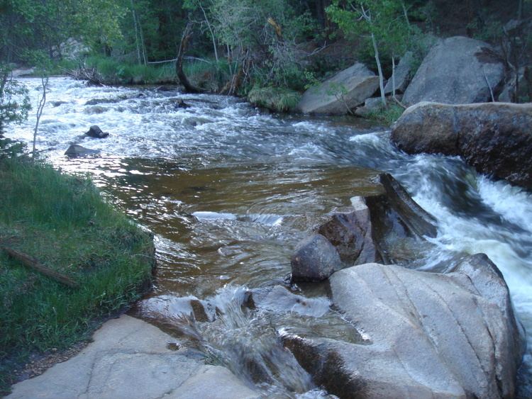
St. Vrain Creek (often known locally as the St. Vrain River) is a tributary of the South Platte River, approximately 32.2 miles (51.8 km) long, in north central Colorado in the United States. It drains part of the foothills north of Boulder and the Colorado Piedmont area in the vicinity of Longmont.
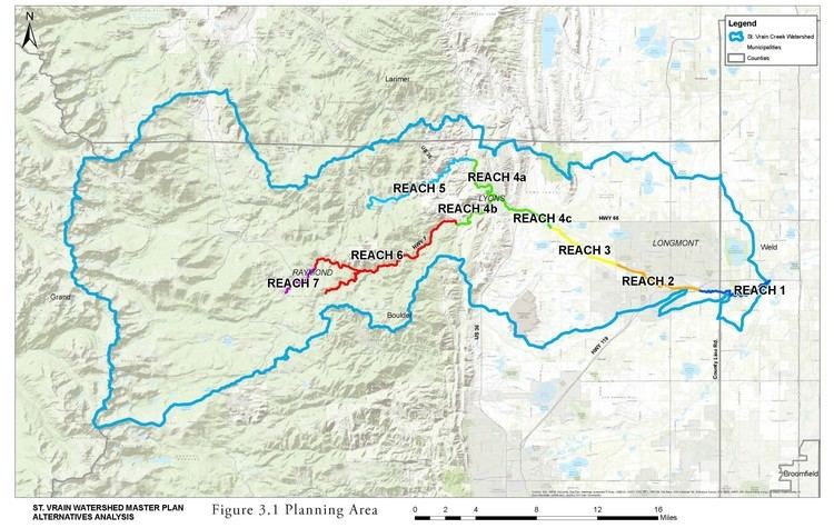
The creek is formed by the confluence of North and South St. Vrain creeks at Lyons. The creek rises in several branches in the foothills of the Front Range northwest of Boulder.
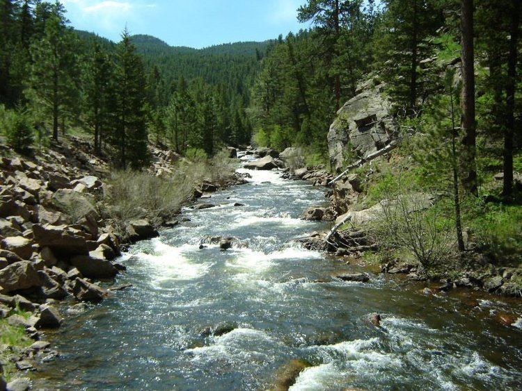
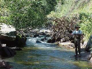
Middle St. Vrain Creek rises along the continental divide, west of St. Vrain Mountain. It descends in canyon to flow along State Highway 7 and past Raymond. It joins the shorter South St. Vrain Creek about two miles below Raymond. South St. Vrain Creek at flood stage is a five mile Class 5+ kayak run at flood stage. North St. Vrain Creek rises northeast of St. Vrain Mountain near Allenspark and descends in a remote canyon to the east along U.S. Highway 36. The two branches join at Lyons, at the mouth of the canyon. East of Lyons, the combined stream flows southeast through farmland and ranch country, passing south of Hygiene and entering Longmont. It passes through the south side of Longmont where it is rimmed by a greenway trail and several parks. East of Longmont it flows generally northeast, meandering through a wide river bottom in ranch country and passing under Interstate 25 south of the intersection with State Highway 66. It joins the South Platte from the west just upstream from the ruins of Fort St. Vrain and approximately 4 miles (6.4 km) northwest of Platteville.
St. Vrain Creek is joined by Left Hand Creek south of Longmont and Boulder Creek east of Longmont.
The stream was named after Ceran St. Vrain, a pioneer trader.