
Website SFSO statistics Area 12.15 km² Population 241 (31 Dec 2008) Sfos number 3931 | Canton Graubünden Elevation 688 m Local time Saturday 6:39 AM District Plessur District | |
 | ||
Weather 6°C, Wind S at 6 km/h, 79% Humidity | ||
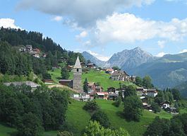
St. Peter-Pagig is a former municipality in the district of Plessur in the Grisons, Switzerland. It was formed on 1 January 2008 through the merger of St. Peter and Pagig. On 1 January 2013 the former municipalities of St. Peter-Pagig, Calfreisen, Castiel, Langwies, Lüen, Molinis and Peist merged into the municipality of Arosa.
Contents
Map of 7028 St Peter-Pagig, Switzerland
Geography
Before the merger, St. Peter-Pagig had a total area of 12.1 km2 (4.7 sq mi).
The former municipality is located in the Schanfigg sub-district of the Plessur district on the northern side of the mid-Schanfigg valley.
On the border with the municipality of Molinis is the Sankt Peter-Molinis railway station, on the Chur-Arosa railway line.
Demographics
St. Peter-Pagig had a population (as of 2010) of 214.
St. Peter had a population (as of 2008) of 241. The historical population is given in the following table: