
GNIS ID 442706 | Length 159 km | |
 | ||
Main source Confluence of the East Branch and Center Branch of St. Marys River near St. Marys, Ohio854 ft (260 m) River mouth Confluence with the St. Joseph River to form the Maumee River at Ft. Wayne, Indiana745 ft (227 m) Progression St. Marys River → Maumee River → Lake Erie → Great Lakes → St Lawrence River → Gulf of St. Lawrence | ||
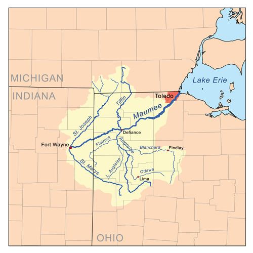
The St. Marys River (Shawnee: Kokothikithiipi ) is a 99-mile-long (159 km) tributary of the Maumee River in northwestern Ohio and northeastern Indiana in the United States. Prior to development, it was part of the Great Black Swamp. Today, it drains a primarily rural farming region in the watershed of Lake Erie.
Map of St Marys River, United States
It is formed in southern Auglaize County in western Ohio by the confluence of the short East Branch and Center Branch. It flows briefly west to St. Marys, approaching to within two miles of Grand Lake before turning to the north. In northwestern Auglaize County it turns sharply to the west-northwest, flowing past Rockford and Willshire into Adams County, Indiana. In northeastern Indiana it flows northwest past Decatur, then enters Fort Wayne. It hooks around in its last half mile (0.8 km) to join the St. Joseph River from the west to form the Maumee in downtown Fort Wayne.
The World War II-era US Navy vessel St. Mary's River was named after this river.