
Country United States County Adams Time zone EST (UTC-5) Elevation 244 m Population 9,418 (2013) | State Indiana Area code(s) 260 Zip code 46733 Local time Sunday 3:00 AM | |
 | ||
Weather -3°C, Wind E at 14 km/h, 73% Humidity | ||
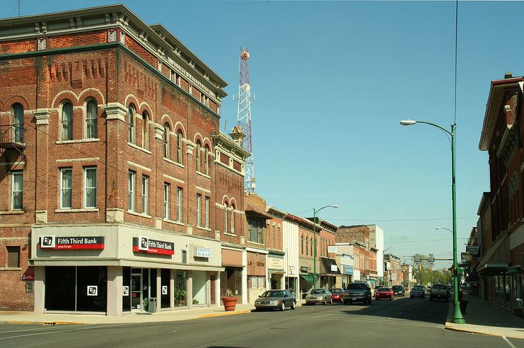
Decatur is a city in Root and Washington townships, Adams County, Indiana, United States. It is the county seat of Adams County. Decatur is home to Adams Memorial Hospital, which was designated as one of the "Top 100" Critical Access Hospitals in the United States. The population of Decatur was 9,405 at the 2010 census.
Contents
- Map of Decatur IN 46733 USA
- History
- Geography
- 2010 census
- 2000 census
- Government
- Education
- Economy
- Notable people
- References
Map of Decatur, IN 46733, USA
History
The first non-Native American settlers arrived in what is now Decatur in 1835. They arrived as a result of the end of the Black Hawk War as well as the completion of the Erie Canal. They consisted entirely of settlers from New England. These were "Yankee" settlers, that is to say they were descended from the English Puritans who settled New England in the colonial era. They were primarily members of the Congregational Church though due to the Second Great Awakening many of them had converted to Methodism and some had become Baptists before coming to what is now Decatur. The Congregational Church subsequently has gone through many divisions and some factions are now known as the Church of Christ and Church of God. When the New England settlers arrived in what is now Decatur there was nothing but a dense virgin forest and wild prairie.
Decatur was founded in 1836. It was named for Stephen Decatur, Jr., one of the captains of the original six frigates of the US navy. The first post office in Decatur was established in 1837.
Geography
Decatur is located at 40°49′46″N 84°55′45″W (40.829581, -84.929185).
According to the 2010 census, Decatur has a total area of 5.786 square miles (14.99 km2), of which 5.78 square miles (14.97 km2) (or 99.9%) is land and 0.006 square miles (0.02 km2) (or 0.1%) is water.
2010 census
As of the census of 2010, there were 9,405 people, 4,011 households, and 2,511 families residing in the city. The population density was 1,627.2 inhabitants per square mile (628.3/km2). There were 4,427 housing units at an average density of 765.9 per square mile (295.7/km2). The racial makeup of the city was 94.7% White, 0.5% African American, 0.4% Native American, 0.4% Asian, 2.6% from other races, and 1.4% from two or more races. 8.4% Hispanic or Latino of any race.
There were 4,011 households of which 31.3% had children under the age of 18 living with them, 43.7% were married couples living together, 13.6% had a female householder with no husband present, 5.4% had a male householder with no wife present, and 37.4% were non-families. 33.1% of all households were made up of individuals and 13% had someone living alone who was 65 years of age or older. The average household size was 2.32 and the average family size was 2.92.
The median age in the city was 37.2 years. 24.7% of residents were under the age of 18; 9.4% were between the ages of 18 and 24; 25.6% were from 25 to 44; 25.7% were from 45 to 64; and 14.6% were 65 years of age or older. The gender makeup of the city was 48.4% male and 51.6% female.
2000 census
As of the census of 2000, there were 9,528 people, 3,960 households, and 2,570 families residing in the city. The population density was 1,935.4 people per square mile (747.7/km²). There were 4,190 housing units at an average density of 851.1 per square mile (328.8/km²). The racial makeup of the city was 94.64% White, 0.24% African American, 0.35% Native American, 0.36% Asian, 0.06% Pacific Islander, 3.58% from other races, and 0.78% from two or more races. Hispanic or Latino of any race were 7.69% of the population.
There were 3,960 households out of which 32.4% had children under the age of 18 living with them, 48.5% were married couples living together, 12.2% had a female householder with no husband present, and 35.1% were non-families. 31.4% of all households were made up of individuals and 13.7% had someone living alone who was 65 years of age or older. The average household size was 2.39 and the average family size was 3.00.
In the city, the population was spread out with 26.4% under the age of 18, 9.8% from 18 to 24, 28.7% from 25 to 44, 20.5% from 45 to 64, and 14.6% who were 65 years of age or older. The median age was 35 years. For every 100 females there were 94.9 males. For every 100 females age 18 and over, there were 90.5 males.
The median income for a household in the city was $37,234, and the median income for a family was $44,722. Males had a median income of $31,819 versus $24,310 for females. The per capita income for the city was $18,186. About 5.6% of families and 7.7% of the population were below the poverty line, including 9.7% of those under age 18 and 11.3% of those age 65 or over.
Government
The government consists of a mayor and a city council. The mayor is elected in citywide vote. The city council consists of five members. Four are elected from individual districts. One is elected at-large. There is also a clerk-treasurer who is elected in citywide vote.
Education
The local high school in Decatur is Bellmont High School; approximately 700 students attend BHS. Local elementary and middle school students attend Southeast Elementary, Northwest Elementary, and Bellmont Middle School. St. Joseph Catholic School serves students in grades K-8. Zion Lutheran School, Wyneken Memorial Lutheran School, and St. Peter-Immanuel Lutheran School also serve students in grades PK-8.