
Country United States Elevation 725 ft (221 m) Local time Friday 4:25 PM Area code 219 | Founded 1837 Zip code 46373 Population 15,677 (2013) | |
 | ||
Weather 26°C, Wind SW at 37 km/h, 40% Humidity | ||
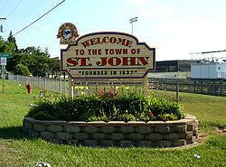
St. John is a town in Lake County, Indiana, United States. The town of St. John has homes in St. John Township, Hanover Township, and Center Township. St. John was founded in 1837. The population was 14,850 at the 2010 census. In 2009, St. John ranked 48th among CNN's top 100 places to live in the United States. In 2014, St. John was ranked as the 4th safest place in Indiana by Movoto Real Estate.
Contents
Map of St John, IN, USA
History
The St. John post office was established in 1846. The town was named for John Hack, a pioneer settler.
The Francis P. Keilman House was listed in the National Register of Historic Places in 2013.
Geography
St. John is located at 41°26′54″N 87°28′36″W.
According to the 2010 census, St. John has a total area of 11.481 square miles (29.74 km2), of which 11.39 square miles (29.50 km2) (or 99.21%) is land and 0.091 square miles (0.24 km2) (or 0.79%) is water.
2010 census
As of the census of 2010, there were 14,850 people, 5,047 households, and 4,225 families residing in the town. The population density was 1,303.8 inhabitants per square mile (503.4/km2). There were 5,201 housing units at an average density of 456.6 per square mile (176.3/km2). The racial makeup of the town was 93.5% White, 1.3% African American, 0.1% Native American, 1.3% Asian, 0.1% Pacific Islander, 2.4% from other races, and 1.2% from two or more races. Hispanic or Latino of any race were 8.2% of the population.
There were 5,047 households of which 40.2% had children under the age of 18 living with them, 75.5% were married couples living together, 5.6% had a female householder with no husband present, 2.6% had a male householder with no wife present, and 16.3% were non-families. 13.9% of all households were made up of individuals and 6% had someone living alone who was 65 years of age or older. The average household size was 2.94 and the average family size was 3.25.
The median age in the town was 40.2 years. 27.3% of residents were under the age of 18; 6.3% were between the ages of 18 and 24; 23.6% were from 25 to 44; 31.2% were from 45 to 64; and 11.3% were 65 years of age or older. The gender makeup of the town was 49.9% male and 50.1% female.
2000 census
As of the census of 2000, there were 8,382 people, 2,800 households, and 2,441 families residing in the town. The population density was 1,246.6 people per square mile (481.6/km²). There were 2,847 housing units at an average density of 423.4 per square mile (163.6/km²). The racial makeup of the town was 91.55% White, 0.13% African American, 0.17% Native American, 0.47% Asian, 0.75% from other races, and 0.93% from two or more races. Hispanic or Latino of any race were 4.20% of the population.
There were 2,800 households out of which 43.3% had children under the age of 18 living with them, 79.8% were married couples living together, 5.1% had a female householder with no husband present, and 12.8% were non-families. 11.1% of all households were made up of individuals and 4.9% had someone living alone who was 65 years of age or older. The average household size was 2.99 and the average family size was 3.24.
In the town, the population was spread out with 28.4% under the age of 18, 6.5% from 18 to 24, 28.3% from 25 to 44, 28.0% from 45 to 64, and 8.9% who were 65 years of age or older. The median age was 39 years. For every 100 females there were 100.9 males. For every 100 females age 18 and over, there were 98.0 males.
The median income for a household in the town was $71,378, and the median income for a family was $75,231. Males had a median income of $55,554 versus $30,603 for females. The per capita income for the town was $25,106. About 1.1% of families and 1.7% of the population were below the poverty line, including 0.9% of those under age 18 and 2.9% of those age 65 or over.
Education
St. John is served mostly by the Lake Central School Corporation (north of 101st Ave and west of Cline Ave), the Hanover Community School Corporation (south of 101st Ave and west of Cline Ave), and the Crown Point Community School Corporation (south of 101st Ave and east of Cline Ave). Three of the ten Lake Central schools are located in Saint John. These include:
In addition to public schools, the community is home to Crown Point Christian School: an evangelical school headed by a parent-owned association. It is also home to St. John the Evangelist Catholic School, a Roman Catholic school.
Awards
In 2009, St. John was ranked 48th on the CNNMoney.com Top 100 "Best Places to Live" list. [1]
In 2014, St. John was ranked as the 4th safest place to live in Indiana. [2]