
Legislature House of Commons District created 1966 Last contested 2015 Province Ontario | MP Chris Bittle
Liberal First contested 1968 District webpage profile, map Elector 83,821 | |
 | ||
Census divisions Regional Municipality of Niagara, St. Catharines | ||
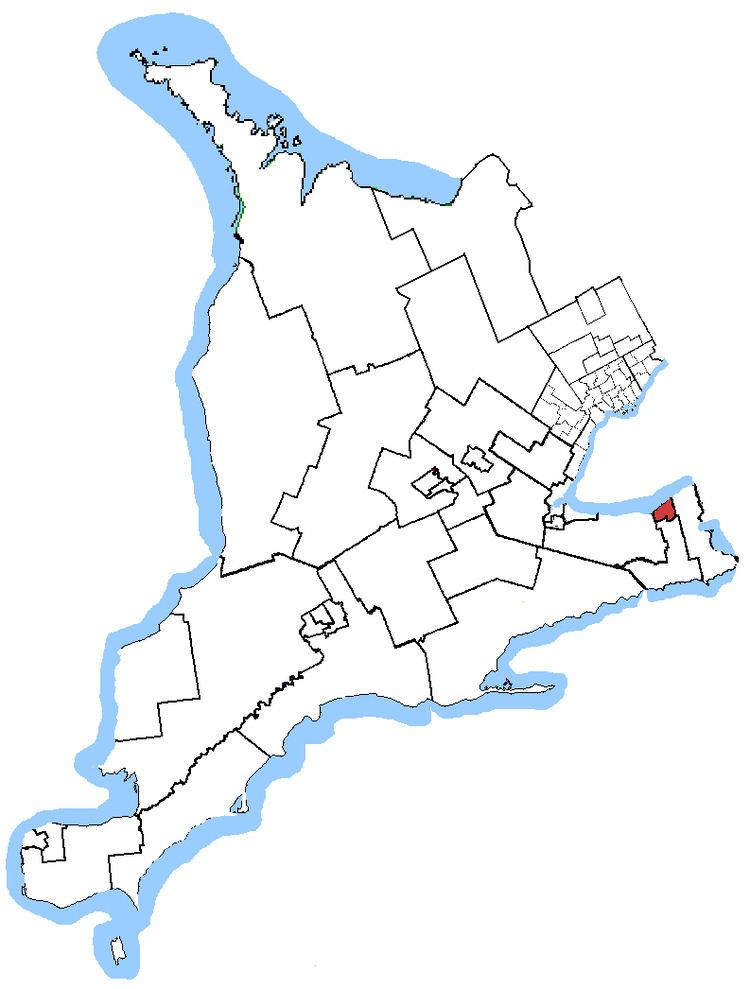
St. Catharines is a federal electoral district in the Niagara Region of Ontario, Canada, that has been represented in the House of Commons of Canada since 1968.
Contents
It consists of the part of the City of St. Catharines lying east and north of a line drawn from Lake Ontario: Courtleigh Road, Third Street Louth, the QEW, Highway 406, First Street Louth, St. Paul Street West, St. Paul Crescent, Twelve Mile Creek, Glendale Avenue, Merrit Street and Glendale Avenue.
History
It was created in 1966 from parts of Lincoln riding.
It consisted initially of the part of the City of St. Catharines bounded on the east by the eastern city limit, and on the north, west and south by a line drawn from the city limit southwest along Eastchester Avenue, south along Bunting Road, southwest along Rockwood Street, south along Hartzell Road, northwest along the Canadian National Railway (CNR) line, south along Glengarry Road, east along Glendale Avenue, south along Mountain Street and east along Bradley Street to the city limit.
In 1976, it was redefined to consist of the part of the City of St. Catharines lying north of the Canadian National Railway.
In 1987, it was redefined to consist of the part of the City of St. Catharines lying north of a line drawn from west to east along St. Paul Street West, St. Paul Street West to St. Paul Crescent, the old Welland Canal, Carter Creek, the first Canadian National Railway spur line and the main CNR line and Queenston Street.
In 1996, it was redefined to consist of the part of the City of St. Catharines lying north and east of a line drawn from the western city limit along St. Paul Street West, St. Paul Crescent, the Old Welland Canal, Carter Creek, the first Canadian National Railway spur line, the most easterly Canadian National Railway spur line and the yard line to the southern city limit.
In 2003, it was given its current boundaries as described above.
This riding lost fractions of territory to Niagara West and Niagara Centre during the 2012 electoral redistribution.
Federal riding associations
Riding associations are the local branches of the national political parties:
Members of Parliament
This riding has elected the following members of the Canadian House of Commons: