
 | ||
Wests pub chichester st peter the great s church kirkja or in a lkr
St Peter the Great is a suburb of the City of Worcester in Worcestershire, England. It is almost due south of the city centre, on the east side of the river Severn, and due south of the Cathedral. Maps of the area in 1977 show just a main road and a single country road with a few cottages. Now it has a growing population which was recorded as 5,620 in 2001.
Contents
- Wests pub chichester st peter the great s church kirkja or in a lkr
- Map of Saint Peter the Great County UK
- Climate
- References
Map of Saint Peter the Great County, UK
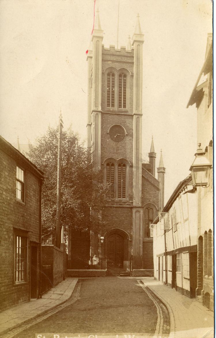
The parish is named after the church of St Peter the Great. The parish of the church had two parts - St Peter the Great City and St Peter the Great County. St Peter the Great County was originally the part of St Peter's parish outside the City of Worcester. When the church of St Peter the Great in Sidbury was closed and demolished, the parish of St Peter was joined with that of St Martin, and the new parish of St Martin with St Peter came into existence in 1974. St Peter the Great church (so named due to a second St Peter church the other side of the cathedral) was located between King Street and Sidbury but was closed in 1972 and demolished in 1976. The congregation and the war memorial were transferred to St Martin church on the London Road. The original church site is now housing and a car park (2016). The nearby junior school of St Peter's was closed during the 1960s, the buildings were purchased by Worcester Porcelain factory and now houses the Museum of Royal Worcester.
St Peter the Great County Parish was established as a Civil Parish around 1993/1994 when the area was annexed to the City of Worcester under the Local Government Act 1972, in 1974, having previously formed part of Pershore Rural District.
St Peter the Great, or "St Peters" as it is commonly abbreviated to, is mainly a large housing estate with a large Tesco superstore, a petrol station and a small shopping area containing a convenience store, a Chinese takeaway, a chip shop, a dentist, a beauty salon, chemist, dry cleaner, charity shop and a part-time GP surgery close to the village hall. In 2007, despite objections from some local residents, a Baptist church opened close to the centre of the estate, the church centre is used for worship, meetings and youth activities also meetings of other groups.
The parish is within a mile of Junction 7 of the M5 motorway and within three miles of the centre of Worcester.
In September 2013, a large scale planning request was made to the County Council to build further dwellings, together with commercial and light industrial buildings.
Climate
Worcester enjoys a temperate climate with warm summers and mild winters generally. However, the city can experience more extreme weather and flooding is often a problem. During the winters of 2009-10 and 2010-11 the city experienced prolonged periods of sub-freezing temperatures and heavy snowfalls. In December 2010 the temperature dropped to −19.5 °C (−3.1 °F) in nearby Pershore. The Severn and the Teme partially froze over in Worcester during this cold snap. In contrast, Worcester recorded 37 °C (98.6 °F) on 3 August 1990.
Between 1990 and 2003, weather data for the area was collected at Barbourne, Worcester. After the closure of this weather station, the nearest one is located at Pershore.