
OS grid reference SZ 14441 95299 | Sovereign state United Kingdom Postcode district BH23 | |
 | ||
Address Sandy Ln, Christchurch BH23 6AQ, UK | ||
St Catherine's Hill is a 53-metre (174 ft) hill in the borough of Christchurch which, together with Ramsdown and Blackwater hills, forms a ridge between the Avon and Stour valleys. It is a Site of Special Scientific Interest with some areas additionally designated as Special Protection Areas and/or Special Areas of Conservation. The hill provides a range of habitats with both wet and dry heathland, coniferous and broadleaf woodland and scrubland; and is home to some rare flora and fauna including the sand lizard, smooth snake, silver-studded blue butterfly and two types of carnivorous plant.
Contents
Humans have been visiting the hill as far back as the Bronze Age and there are a number of ancient monuments sited there including several tumuli, a Roman signal station and what is thought to be an Iron Age animal pound. The military have made extensive use of the area since at least the Roman occupation; it served as training ground for troops during the Crimean War and both World Wars, and was the site of a nuclear bunker during the Cold War. Most visitors today use the hill as an area to exercise their dogs or for other recreational activities such as cycling, jogging and horse riding.
Toponymy
It is largely thought that the hill takes its name from the chapel that once stood on it which in turn was named after the 4th-century Christian martyr who was imprisoned, tortured and condemned to death for her beliefs. At one time the hill known as Katterns and this has prompted speculation that the name pre-dates the chapel and is linked to a Pagan deity. A document from 1332 describes "St Catherine's chapel on the hill of Rishton", although other records indicate that a hill further north was known as Rishton. This other hill was also the site of a chapel but dedicated to St Leonard.
History
Animal remains from before the ice age have been discovered on the hill although much of the gravel that covers the area was deposited by fast moving melting ice and it is possible therefore that some of the remains were washed there. Large numbers of Mesolithic tools and a few Paleolithic tools have been found there and across the local area, including a flint knapping site at nearby Ramsdown Hill. The presence of long barrows in the adjacent Stour valley demonstrates that Neolithic peoples were using the area but if they visited the hill, there is no direct evidence remaining. There are however, Bronze Age tumuli over all three hills including St Catherine's and agricultural sites in the valley below from both the Neolithic and Bronze Age. There is also an unexcavated enclosure on top of the hill which is considered too small to be a fort and is currently thought to be an Iron Age animal pound.
It is likely that St Catherine's Hill with its commanding views was used as a lookout post. Christchurch Harbour was an important trading port in the Iron Age and through the Saxon and Roman periods; and the hill overlooks the Avon and Stour rivers, both navigable, until the 18th century, as far as Salisbury and Blandford respectively. Fragments of Roman pottery have been found in a ditch, which appears to be part of a fortification or signal station overlooking the main road from Christchurch to Wimborne and an important fording point on the River Stour. With the addition of a simple wooden tower, the River Avon, the harbour and Hengistbury Head would also have been viewable from this point.
Later a chapel was built within the boundaries of the old Roman signal station. Although it is not certain when the chapel was constructed, it must have existed by 1302 when a record was made of an unlicensed mass being held there. The chapel, by then known as St Catherine's Chapel, was licensed for major rites in 1332. It is presumed that the chapel was destroyed during the dissolution, in 1539 at the same time as the monastery at Christchurch. The chapel site was excavated in 1967 and a number of artefacts were found including an ichthys drawn on a piece of stone, glazed and unglazed pottery, and some shards of mediaeval coloured glass. The discovery of two types of flooring, a glazed tile floor and an earlier marble one, along with seven types of building stone and eight different roof tiles, led to the conclusion that the chapel had stood for a considerable amount of time. It is said that the hill was initially chosen as the site for Christchurch Priory but the building materials were moved each night to the church's present location.
During Tudor times the hill was classified as a Coast Hill Beacon, meaning it had two fire baskets. Shore Beacons, such as nearby Warren Hill had three fire baskets while those inland had one. It is possible that these beacons were lit to warn of the approaching Spanish Armada. The hill continued to be used as a beacon hill throughout the Napoleonic Era when an invasion by the French was expected. The military has made extensive use of the hill for training purposes. During the Crimean War, when a battalion of the Royal Horse Artillery was stationed at Christchurch Barracks, the hill was used for training in the pulling and unlimbering of guns on rough terrain.
20th century
During World War I a complete set of trenches were built on the hill including firing, communication and second line trenches; observation and machine gun posts, dressing stations, latrines, mine shafts, and various rooms and strong points. Soldiers were trained in trench warfare and construction there prior to being sent to Flanders. The area was also used during the Second World War, for tank driving practice. Anti-aircraft guns were also positioned there to protect the aerodrome at Hurn. After the war, a nuclear bunker was built into the hill by the Royal Observer Corps. It was designed so that a three-man team could survive within for up to three weeks whilst observing the effects of a nuclear blast. After closing in 1991 the ROC Post was filled in, with the only remaining feature being a single disused telegraph pole 15 yards away.
Sand and gravel extraction has taken place over various parts of the hill, most notably on the east side of the plateau, where the whole of what was once Toothill has been removed. The remaining pit is today partly filled with water. Gravel extraction continued until at least 1933 when a local newspaper complained that a tumulus was being sold off at a shilling a load. A reservoir was first constructed on the hill in 1895. It was rebuilt in 1930 and a second reservoir was added in 1960. The reservoirs provide Christchurch and West Hampshire with 4,000,000 gallons of water. In the 1960s and 70s, most of the west side of the hill was developed for housing.
Today
Today the hill is mainly used for leisure and educational activities, such as walking, jogging, cycling and horse riding. Dog walking in particular is popular with 70% of visitors using it for this purpose; and although prohibited, off-road quadbiking and motorcycling also occurs. A local branch of the Amphibian and Reptile Conservation group (ARC) manage an area of heath on the north and east sides of the hill, and is one of a number of groups that conduct guided walks around the hill and surrounding area; while on the south side, the local gun club practises target shooting in one of the old, disused quarries.
Geography
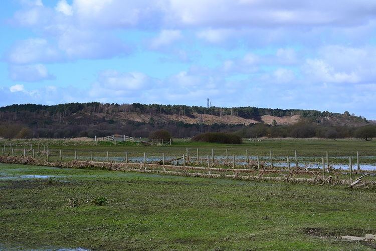
St Catherine's Hill, together with Ramsdown and Blackwater hills, comprise a three-mile long ridge which runs roughly north to south between the Avon and Stour valleys just to the north-west of where the rivers converge in the borough of Christchurch in Dorset. The top of this ridge is almost a level plateau, 45 metres (148 ft) above sea-level at the southern end and 49 metres (161 ft) in the north. St Catherine's hill, in the south, forms the highest point of this three hill chain at 53 metres (174 ft) and has some of the steepest slopes at 1:1 or 45°. The 400 acre site is a mixture of woodland and heath and is part of a larger Site of Special Scientific Interest (SSSI). The eastern slopes and foot of the hill, an area referred to as the Town Common, is almost exclusively open heath and as such has also been designated a Special Protection Area (SPA) and Special Area of Conservation (SAC).
St Catherine's Hill was formed during the Eocene and Pleistocene eras. The hilltop is covered with river terrace gravels, comprising mainly flints and coarse sands, on top of finer Branksome Sands below which is Parkstone Clay and the Poole Formation. A number of these strata can be observed at the old quarry works and believed to have been deposited during a fluvial or estuarine period (all others were formed in a marine environment). If this is so, they are the only known sediments of this age in Southern England to be laid down in this way and indicate an Eocene shoreline between Christchurch and Hengistbury Head. These strata add to the value of the site as a geological SSSI.
The soils covering the hill and surrounding area are acidic and generally low in nutrients. These soils support a selection of habitats from wet and dry heathland, to deciduous and coniferous woodland and scrubland. Dry heath occurs mainly on the top of the hill, well above the water table, where there is good drainage. It is composed mainly of heather and dwarf shrubs but there are bare sandy areas where the rare Mossy Stonecrop (Crassula tillaea) is able to flourish. All six native species of reptile breed here including the endangered sand lizard (Lacerta agilis) and smooth snake (Coronella austriaca). The smooth snake is also found in the areas of wet heath which occur mainly at the foot of the hill and are created by seepage and flushes from below the hill's water table; and where free draining gravelly soils meet less permeable clay. Rare flora found in these areas include bog asphodel (Narthecium ossifragum), hare's-tail cotton-grass (Eriophorum vaginatum), bog moss (Sphagnum), the carnivorous sundews Drosera intermedia and Drosera rotundifolia, and pale butterwort (Pinguicula lusitanica).
Coniferous woodland dominates the top and western slopes of the hill and comprises mostly maritime and Scots pine. Broadleaf trees are mainly confined to the south and west side but also occur on the lower east side. They include grey willow and downy birch and the occasional aspen in damper areas. Some trees, particularly the conifers have become invasive and a programme of removal has been instigated. The hill's mix of woodland and heath provide habitats for a number of important bird species including birds of prey such as the hobby (Falco subbuteo), buzzard (Buteo buteo), hen harrier(Circus cyaneus) and merlin (Falco columbarius); woodland birds including the song thrush (Turdus philomelos), crossbill (Loxia curvirostra) and green (Picus viridus) and great spotted woodpecker (Dendrocopos major), all of which are declining in numbers; and wetland birds such as snipe and the red shank (Tringa totanus). Many of these birds also use the area for breeding along with the rare Dartford warbler (Sylvia undata), woodcock (Scolopax rusticola) and nightjar (Caprimulgus europaeus).
Some rare invertebrates inhabit the hill and its surrounding area. The scarce chaser (Libellula fulva), hairy dragonfly (Brachytron pratense) and downy emerald (Cordulia aenea) all make use of the ponds in the wetter areas of the heath, while the heath grasshopper (Chorthippus vagansand) can be found on the sandy areas among the heather along with the silver-studded blue butterfly (Plebejus argus).