
Local time Thursday 8:38 AM | Population (approx.) 920 | |
 | ||
Weather 7°C, Wind NW at 14 km/h, 83% Humidity | ||
Stępina [stɛmˈpʲina] is a village in the administrative district of Gmina Frysztak, within Strzyżów County, Subcarpathian Voivodeship, in south-eastern Poland. It lies approximately 7 kilometres (4 mi) north-west of Frysztak, 16 km (10 mi) west of Strzyżów, and 36 km (22 mi) south-west of the regional capital Rzeszów.
Contents
Map of St%C4%99pina, Poland
The village has an approximate population of 920.
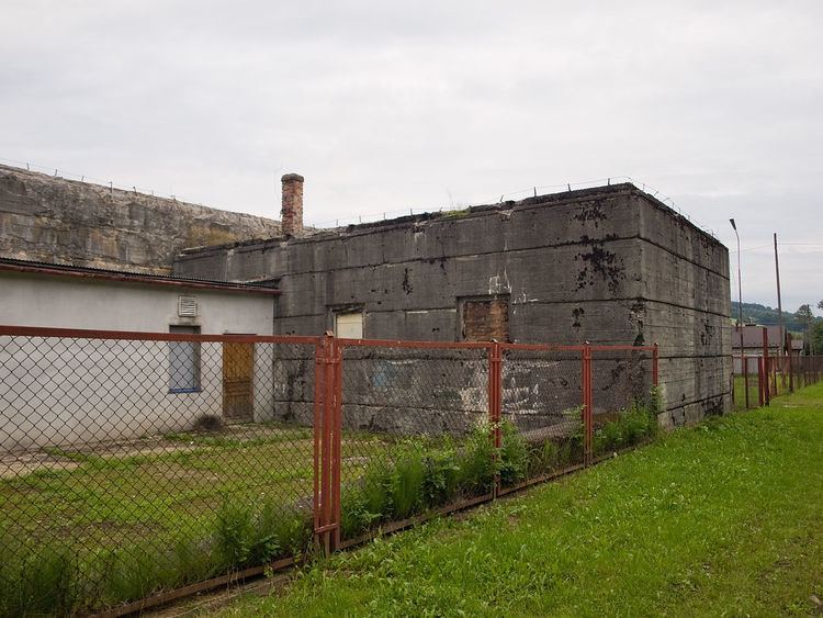
World War II
Stępina is the location of one of Hitler's bunkers called Anlage Süd, built in 1940-1941 with slave-labor from the Szebnie concentration camp nearby. Over the course of the camp's operation some 10,000 people perished, including Soviet prisoners of war, Polish Jews, non-Jewish Poles, as well as Ukrainians and Romani people.
The remains of the camp in Szebnie were entered by the Soviets on 8 September 1944 during counter-offensive of the Red Army.