To: Jammu, Jammu district | Length 295 km | |
 | ||
From: Lal Chowk, Srinagar district Major cities Srinagar, Jammu, Udhampur, Anantnag, Ramban, Pulwama | ||
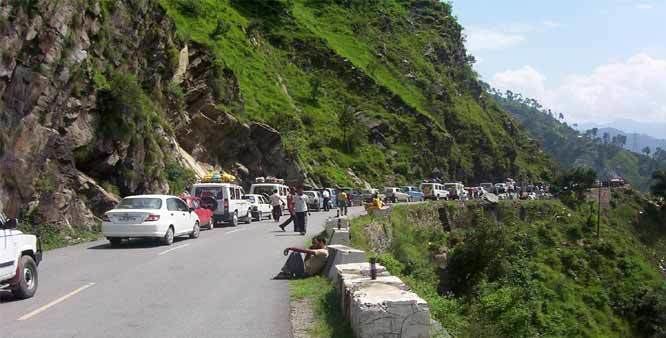
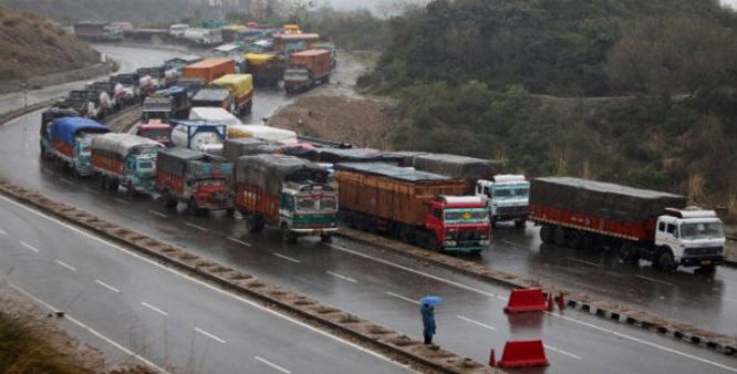
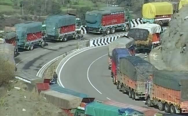
Srinagar Jammu National Highway is a part of NH 44 (former name NH 1A before renumbering of all national highways) system and connects Srinagar (Kashmir Valley) with Jammu City. The distance between Jammu Tawi and Srinagar was 295 km and is expected to reduce by about 80 km after commissioning of Chenani-Nashri Tunnel, new Banihal road tunnel and other small tunnels. These tunnels will also help keep the highway open during winter avalanches. It is one of the two road links (other being Mughal road) that connects Kashmir Valley with the rest of India. The traffic on the highway is controlled by two control rooms, one in Srinagar and other in Jammu.
Contents
Features
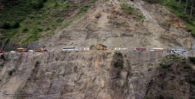
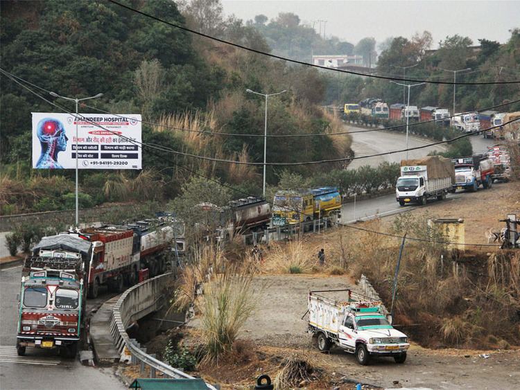
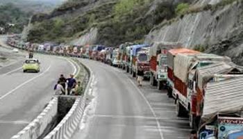
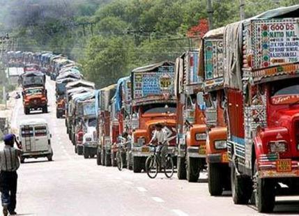
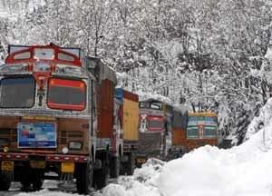
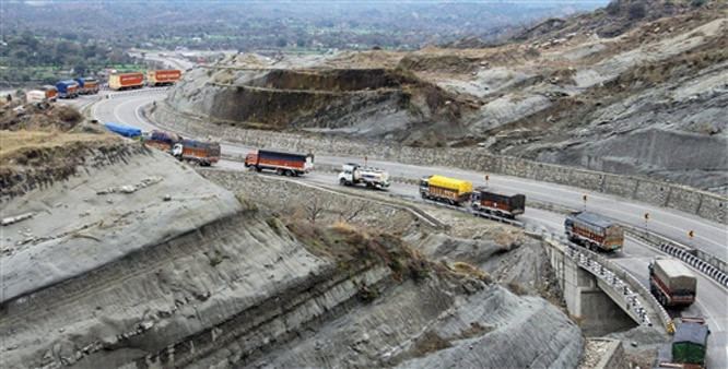
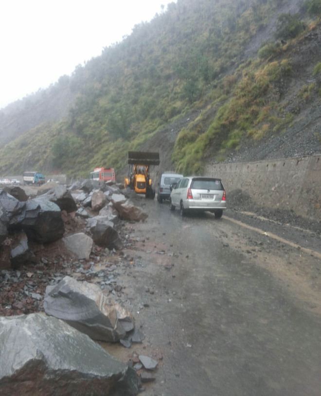
The highway starts from Lal Chowk, Srinagar and then passes through Pulwama district, Anantnag district, Kulgam district, Ramban district, Udhampur district and ends in Jammu city. The highway lies in Kashmir valley for first 68 km up to Qazigund and then passes through series of Mountains up to Jammu. The highway is famous for Patnitop Hill station, Jawahar Tunnel, Sweets of Kud and Tea of Sarmuli. The highway is often closed during winter days due to heavy snowfall in Kashmir valley and district Ramban. Many landslides and avalanches in the mountainous region leads to closure of highway during winters.
The government of Jammu and Kashmir spents lot of money every year on maintenance of the highway. At many sites new roads with less number of road curves and tunnel are constructed which would not only provide comfort to the passengers but would also reduce distance between two cities.
The railway line connecting Baramulla at the western end of Kashmir Valley with Banihal across the Pir Panjal Range of mountains has eased traffic on the highway as many people prefer to travel in train up to Banihal because train travel is both economical and time-saving. The distance between Qazigund, north of the Pir Panjal mountains, and Banihal, south of Pir Panjal mountains, is 35 km by road compared to only 17 km by railway and the train takes hardly one-fourth time and fare. After reaching Banihal railway station, people take the road (mainly bus) to reach Udhampur or Jammu.
Traffic control rooms
Traffic on the highway is controlled by Traffic control rooms of two capitals.
These numbers help the people to get latest updates on the conditions of the highway and help them to postpone their journey in case of bad weather.