
Division Sylhet Division Time zone BST (UTC+6) Area 450.7 km² | District Maulvibazar District Postal code 3210-14 Local time Friday 12:37 AM | |
 | ||
Weather 23°C, Wind E at 0 km/h, 93% Humidity | ||
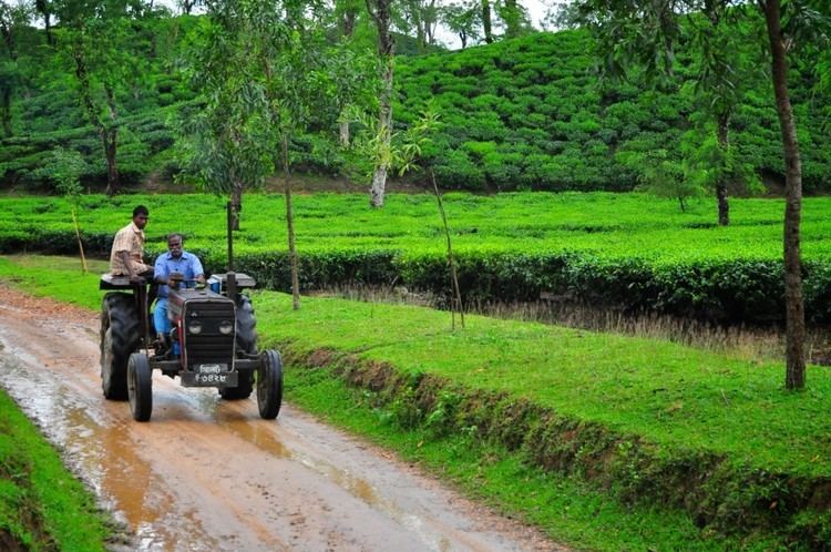
Trip to sylhet a pure family tour
Srimangal (Bengali: শ্রীমঙ্গল) is an Upazila of Maulvibazar District in the Division of Sylhet, Bangladesh.
Contents
- Trip to sylhet a pure family tour
- Map of Sreemangal Upazila Bangladesh
- Geography
- Demographics
- Administration
- Education
- References
Map of Sreemangal Upazila, Bangladesh
Geography
Srimangal is located at 24.3083°N 91.7333°E / 24.3083; 91.7333. It has 43,952 households and total area 450.74 km².
Demographics
As of the 1991 Bangladesh census, Srimangal has a population of 230,889. Males constitute 51.76% of the total population, and females 48.24%. This Upazila's 18+ population is 124,778. Srimangal has an average literacy rate of 29.8% (7+ years), and the national average of 32.4% literate. Hindus constitute around 45% of the total population making up over one lakh, making it a city with one of the highest concentration of Hindus in Bangladesh.
Administration
Srimangal has 9 Unions/Wards, 129 Mauzas/Mahallas, and 206 villages.
Education
According to Banglapedia, Victoria High School, founded in 1924, is a notable secondary school.