
Location Alberta, Canada Easiest route Scramble Province Alberta Parent range Fairholme Range | Topo map NTS 82O/03 Elevation 2,514 m Mountain range Fairholme Range | |
 | ||
Similar Mount Charles Stewart, Mount Lady Macdonald, Princess Margaret Mountain, Grotto Mountain, Fairholme Range | ||
Squaw's Tit is an outlier of Mount Charles Stewart in the Canadian Rockies of Alberta. It is located at Lat/Lon: 51.13°N, 115.33°W and is one of the most prominent landmarks in the vicinity of Canmore, Alberta.
Contents
Map of Squaw's Tit, Bighorn No. 8, AB, Canada
"Squaw's Tit" is an unofficial name for the high point of a ridge that lies southwest of the Mount Charles Stewart summit and northwest of Mount Lady Macdonald near Canmore. The peak owes its name to the resemblance it shares with a woman's upturned breast. Due to its politically incorrect name, it is unlikely to receive official status, but is in common use.
Belonging to the Fairholme Range in Kananaskis Provincial Park, Squaw's Tit is located 4,000 feet (1,200 m) above the Bow River valley. It is 2 kilometres (1.2 mi) northwest of Lady Macdonald, just east of the Banff National Park gates.
Routes
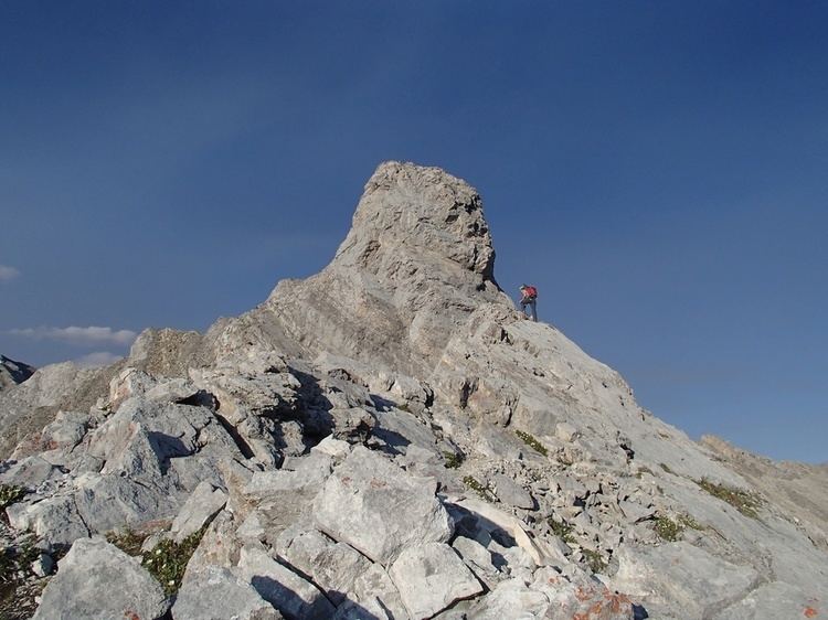
The scrambling route is graded moderate but includes exposure and thus is strongly recommended that the ascent only be done in dry conditions. Follow the major drainage ditch behind Harvey Heights and stay close along the right (south) side of the ditch. Follow this up to the North West ridge all the way to the slabs just below the protruding summit nipple.