
Easiest route Scramble (difficult) First ascent 1886 Province Alberta | Topo map NTS 82O/03 Elevation 2,606 m Prominence 75 m Mountain range Fairholme Range | |
 | ||
Similar Grotto Mountain, Ha Ling Peak, East End of Rundle, Mount Lawrence Grassi, Mount Charles Stewart | ||
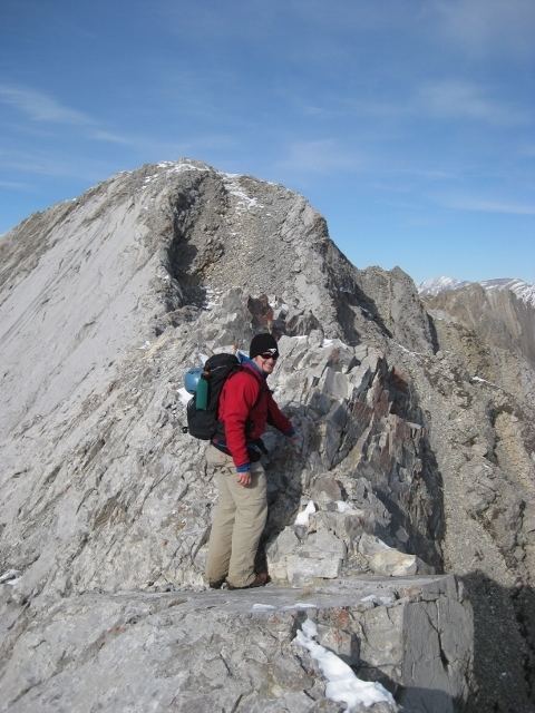
The ridge walk mount lady macdonald canmore alberta canada
Mount Lady Macdonald is a mountain located in the Bow River valley at the town of Canmore, which is located just east of Banff National Park, Alberta, Canada.
Contents
- The ridge walk mount lady macdonald canmore alberta canada
- Map of Mount Lady MacDonald Bighorn No 8 AB Canada
- Mount lady macdonald
- References
Map of Mount Lady MacDonald, Bighorn No. 8, AB, Canada
The mountain was named in 1886 after Susan Agnes Macdonald, wife of Sir John A. Macdonald, the first Prime Minister of Canada. The Macdonald's travelled on the new national railway through the Canadian Rockies in 1886 on their way to Vancouver.
Hikers may hike a trail along the mountain to an abandoned teahouse and helipad just short of the knife's edge ridge that leads to the top of the peaks.
Heading toward the summit from the helipad there is a metal paragliding ramp on the west side of the trail. On August 13, 2011, Stewart Midwinter, an experienced paraglider flying a Speedglider, sustained injuries near Mount Lady Macdonald after losing control of his craft.
Deaths of individuals hiking to or near Mount Lady Macdonald have been reported. On June 7, 2003 a solo hiker was found deceased near the summit after sustaining injuries that investigators attribute to an avalanche accident. On October 16, 2007 a woman reportedly died after a fall while hiking between Mount Lady Macdonald and Mount Charles Stewart.