
Area 16,310 km² | University Quest University | |
 | ||
Points of interest Whistler Blackcomb, Nairn Falls Provincial Park, Garibaldi Provincial Park, The Black Tusk, Birkenhead Lake Provincial Destinations | ||
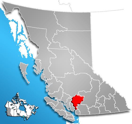
The Squamish-Lillooet Regional District is a quasi-municipal administrative area in British Columbia, Canada. It stretches from Britannia Beach in the south to Pavilion in the north. Lillooet, Pemberton, Whistler and Squamish are the four municipalities in the regional district. Its administrative offices are in the Village of Pemberton, although the district municipalities of Squamish, Whistler, and Lillooet are all larger population centres. The district covers 16,353.68 km² (6,314.19 sq mi) of land area.
Contents
- Map of Squamish Lillooet BC Canada
- Population history
- Squamish Lillooet Electoral Area A British Columbia
- Squamish Lillooet Electoral Area B British Columbia
- Squamish Lillooet Electoral Area C British Columbia
- Squamish Lillooet D British Columbia
- References
Map of Squamish-Lillooet, BC, Canada
The southern end of the regional district comprises the northern part of the traditional territory of the Squamish people, and the northern half constitutes the traditional homeland of the St'at'imc people.
Population history
Squamish-Lillooet Electoral Area A, British Columbia
Electoral Area A comprises the basin of the Bridge River valley above its confluence with the Yalakom River at Moha. The only towns in the area are Bralorne, Gold Bridge and Brexton. Other communities or localities include Gun Lake, Tyaughton Lake and Gun Creek Road.
Population as of 2006 Canadian Census: 207.
Squamish-Lillooet Electoral Area B, British Columbia
Electoral Area B comprises the basin of the Bridge River below its confluence with the Yalakom River at Moha, the valley of Seton and Anderson Lakes (excepting D'Arcy), and the rest of the upper portion of the SLRD surrounding Lillooet and adjoining parts of the Fraser Canyon. Communities include McGillivray Falls, Seton Portage, Shalalth, Texas Creek, Bridge River (meaning Moha and the lower Bridge River communities), West Pavilion, Pavilion and Fountain and Fountain Valley.
Population as of 2006 Canadian census: 575 excluding Indian Reserves, 1719 including Indian Reserves.
Squamish-Lillooet Electoral Area C, British Columbia
Electoral Area C comprises the Pemberton and Gates Valleys and the valley of the Green River north of Whistler. Communities include Pemberton Meadows, Mount Currie, Owl Creek, Birken, Devine, British Columbia, D'Arcy, and McGillivray (formerly McGillivray Falls).
Population as of 2006 Canadian Census:1887 excluding Indian Reserves, 3358 including Indian Reserves.
Squamish-Lillooet D, British Columbia
Electoral Area D comprises the valleys of the Cheakamus and Squamish Rivers and the Sea-to-Sky Corridor south to the SLRD boundary on Howe Sound. Communities include Britannia Beach, Woodfibre, Furry Creek, the Pinecrest and Black Tusk subdivisions nearer Whistler and the uninhabited former recreational settlement of Garibaldi.
Population as of 2006 Canada Census: 839